Nearly half of wildfires burning in B.C. remain out of control, but the number of fires of note are reducing.
As of Monday (Aug. 29), there are 201 active blazes throughout the province. Of them, 93 are considered out of control, 58 are under control, 38 are being held, 10 are new and two are fires of note.
Fires of note are ones that are particularly visible or pose a potential threat to the public. A week ago, six wildfires were classified as such. On Sunday, the Connell Ridge fire near Cranbrook was the latest wildfire to be reclassified and is now considered under control.
Lightning continues to be the leading cause of blazes, claiming 73.6 per cent of fires since the start of the wildfire season and 80.6 per cent of the 201 actively burning. People are believed to behind another 21.2 per cent of this year’s wildfires, and eight per cent of the current ones. The cause of the remaining fires remains unknown.
The majority of active blazes are burning in the southern half of B.C., with 72 in the southeast, 30 in the Kamloops fire region, 11 in the Cariboo region and 38 along the coast. Another 34 are burning in the Prince George fire region and 16 are located in the northwest.
READ ALSO: Baby passes away in Interior B.C. town while waiting for ambulance
The fires of note are located in the Kamloops and southeast fire regions. They include:
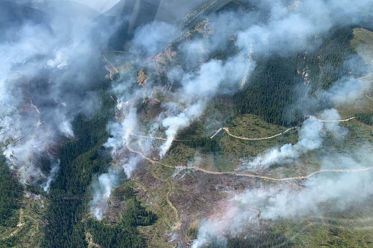
Keremeos Creek
Estimated fire size: 7,017 hectares
Location: 21 kilometres southwest of Penticton
Discovered: July 29
Cause: Under investigation
BC Wildfire Service says some stumps and single trees continue to burn with the fire’s radius, but that they don’t pose a threat and will ultimately self-extinguish.
The fire remains stable along the western side of Highway 3A, although smoke is still visible in the area. BC Wildfire says this will be the case until there is a significant amount of rainfall.
Crews continue to patrol other areas of the blaze, attacking remaining hot spots and securing a a control line (created with water or chemical retardants).
Evacuation alerts have been rescinded, but the Keremeos Creek Forest Service Road remains closed.
There are 78 firefighters, three helicopters and three pieces of heavy equipment on scene.
Weasel Creek
Estimated fire size: 1,088 hectares
Location: 2 kilometres west of Frozen Lake and 39 kilometres southeast of Baynes Lake
Discovered: Aug. 4
Cause: Lightning
Crews continue to patrol the fire, using scan maps to locate hotspots and extinguish them. They’re also working to create a 50-foot blackline (an area purposefully burned to remove all burnable material) along the east flank of the fire.
A leave area order is in effect between the junction of the Flathead Forest Service Road and Kishinea Forest Service Road south on the Flathead Forest Service Road to the junction with Ram Main/Cabin Forest Service Road and Flathead Border Forest Service Road. An area restriction is also in place, and BC Wildfire is reminding people it means they cannot hunt in the region.
There are 61 firefighters on scene, along with two helicopters and eight pieces of heavy equipment.
@janeskrypnek
jane.skrypnek@blackpress.ca
Like us on Facebook and follow us on Twitter.
