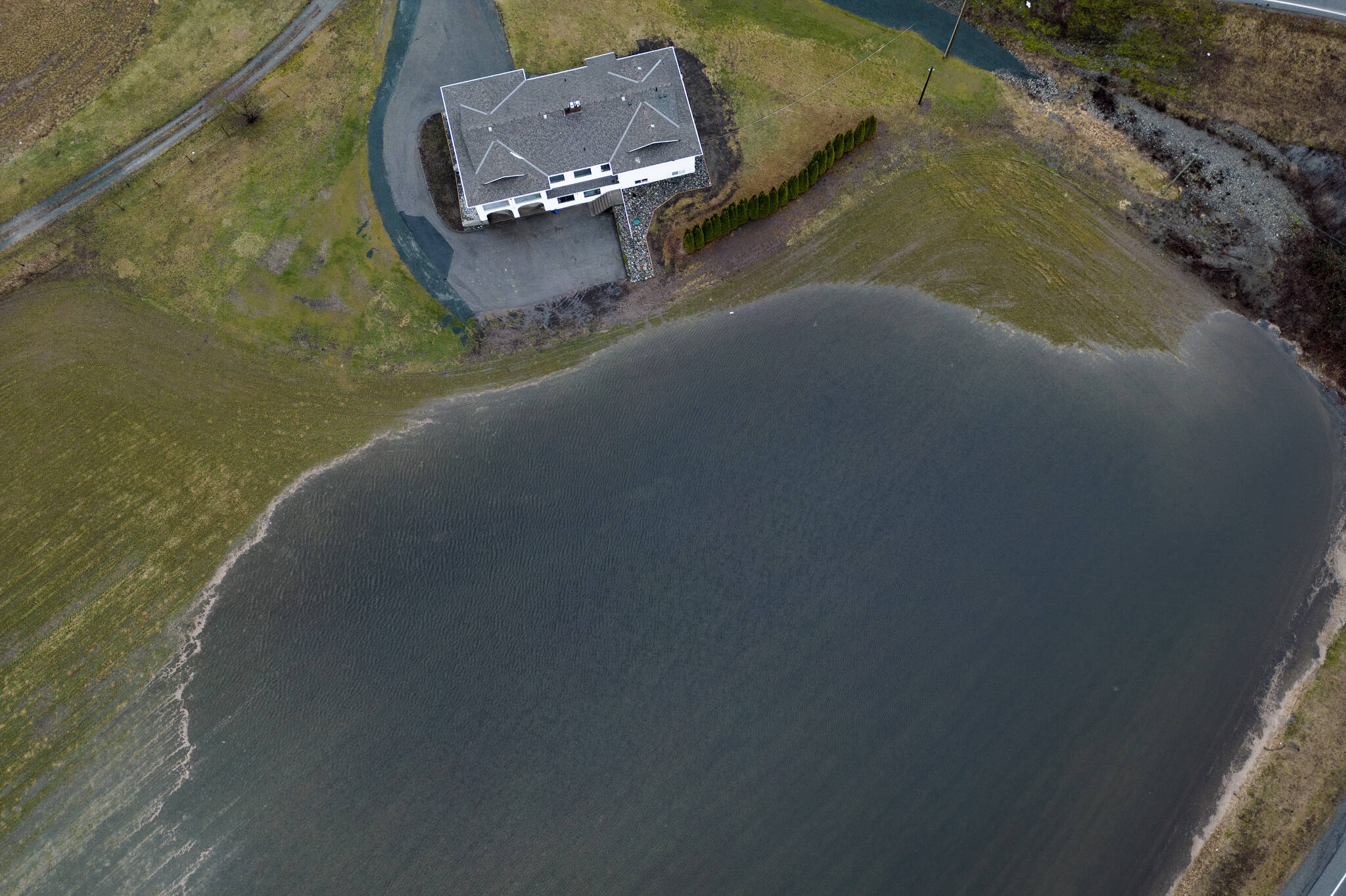
Pemberton resident Dean Matt’s anxiety has waxed and waned this week with the levels of the swollen Lillooet River on B.C.’s South Coast.
Matt, owner of a roofing company, said his property at the river’s edge had been under threat earlier this week.
But he and others received a reprieve Thursday when the Village of Pemberton rescinded evacuation alerts for several dozen properties whose residents had previously been told to be ready to leave on short notice.
British Columbia’s River Forecast Centre lifted a flood warning for the Lillooet and Squamish rivers, saying flows remain high but rainfall and snowmelt are tapering off.
“It was kind of stressful,” said Matt. “That was the Monday or Tuesday night where it was pretty well full, the river.
“We got a good break in the weather on Tuesday, I think it was, so that pretty much saved us. If we wouldn’t have got that break, it would have been scary.”
The river forecast centre also downgraded flood advisories across the province’s South Coast as a stretch of warm, wet weather eased, with forecasts returning closer to seasonal temperatures by the weekend.
“Based on forecasts and current observations on the ground, things are currently looking favourable,” said Pemberton emergency program officer Sarah Toews.
“We’re cautiously optimistic that the kind of worst impacts have passed.”
Environment Canada has also lifted a rainfall warning for the Howe Sound area, including Squamish.
A flood watch remains in effect for the Sproat and Somass rivers on Vancouver Island, while lower-level streamflow advisories cover the rest of the South Coast.
Avalanche Canada, meanwhile, said conditions remained “very dangerous” in alpine areas throughout the Sea to Sky corridor, including mountains surrounding Whistler, Squamish and Pemberton.
“Hunting for dry snow in the alpine will put you closest to harm’s way,” said the latest bulletin posted by the agency for that region.
Environment Canada said another round of daily high-temperature records fell across southwestern B.C. on Wednesday, with West Vancouver reaching 17.9 C, almost three degrees higher than the previous Jan. 31 record set in 1993.
The River Forecast Centre said rain from the warm air system is expected to ease Friday, and cooler conditions should arrive by the weekend.
The forecast is welcome news for Matt, whose property didn’t end up getting flooded or evacuated, although he said the golf courses down the road were partially underwater before the river receded.
“I’m sure they’re going to have quite a cleanup in the spring,” Matt said. “But overall, things are kind of back to normal now.”
An earlier update from the River Forecast Centre said rainfall since last Friday ranged from 70 to more than 500 millimetres across the South Coast, while unseasonable warmth added between 75 and 150 millimetres of snowmelt earlier this week.
READ ALSO: ‘You better have a snorkel’: flood evacuations ordered in Pemberton
