In the wake of intense rains at the close of 2021, a former Salmon Arm engineer objects to storms and climate change being scapegoated as the cause of all bridge and road washouts.
Calvin VanBuskirk says while weather affects results, many washouts in B.C. are both predictable and preventable, including a fatal landslide on Nov. 15, 2021. He is not alone in that belief.
VanBuskirk, a 30-year member of Engineers and Geoscientists of BC who now lives and works on Vancouver Island, wrote in early December to several provincial ministries about the need and the ways to prevent such destruction and tragedy. He pointed to the deaths of five people in the Nov. 15 landslide that washed out Highway 99, also called Duffey Lake Road, between Pemberton and Lillooet. As of Feb. 11, he said he had not yet received a reply.
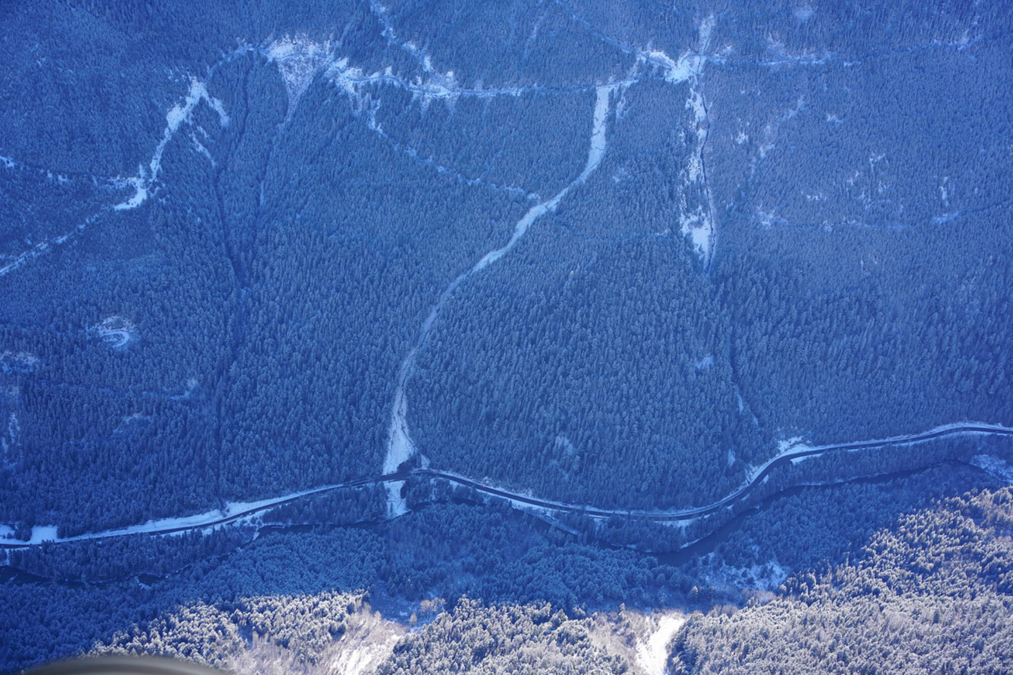
The landslide above Highway 99 started on a resource (logging) road constructed in the late 1960s, which was used until the mid- to late-1990s, he said. From images, it appeared the road was not deactivated and had not been inspected or maintained for a few decades. Deactivation refers to techniques for managing water and preventing slides such as cross-ditching – building ditches across a road to intercept water and direct it onto stable slopes below.
Van Buskirk wrote: “Research supports that concentrated/redirected water from resource (logging) roads and trails is the single greatest cause of landslides in BC, and this has been known for several decades…”
He said photos suggested, had the road above Highway 99 been monitored, the potential for the landslide could have been detected and preventative measures put in place.
Read more: Silver Creek residents anxious after evacuation
Read more: Silver Creek rallies to battle flooding
Pierre Friele agrees. Friele, who belongs to the same professional association as VanBuskirk, is a professional geoscientist.
At least 50 per cent of his work over the last 30 years has been in the forest industry conducting terrain stability assessments, he said. The other portion is doing what are called legislated landslide risk assessments for developments.
“It’s basically my bread and butter.”
Friele said people who work in the field are naturally curious about details regarding landslides, such as what started them. Four days after the lethal Highway 99 slide, a photographer Friele knows, Conny Amelunxen, was going to be flying in the area that day and asked Friele if he wanted any particular photos. Friele asked him to take a photo of the ‘head scarp’ or top of the landslide.
“All of the pictures in the news were coming from the road, where the road was impacted, so we didn’t know where it (the slide) came from. So I was curious to find that out,” Friele said.
When he received the photos the next day, he decided he needed to investigate from the ground. On Nov. 23 he walked from the road up to the top of the landslide. No one had been there before him as there were no footprints in the area, Friele said.
“In this case, the level of deactivation wasn’t consistent with the degree of abandonment. The road was clearly abandoned, but it hadn’t been completely deactivated.”
The problem, he said, was in the area of a switchback. Two older, small landslides had left debris resting on the road below the switchback, plugging a ditch. The water then ran down the road instead of crossing over the road and going down a stable slope.
“Had that road been seasonally monitored, had people been going up there regularly and checking on things, they would have noticed that and corrected it. But because the road was completely abandoned for 20 years or so, then that problem was never identified and ultimately led to the landslide that occurred,” Friele said.
Read more: B.C. declares state of emergency amid devastating floods, landslides
Read more: Highway 99 reopens to essential traffic following Dec. 1 mudslide
In his letter to the provincial government, VanBuskirk said he suspects an investigation of the landslide and fatalities by the B.C. Coroner and possibly the Forest Practices Board could take about two years. In the interim, he suggested an inter-agency task force be formed for the identification, management and reduction of landslide risks associated with resource roads.
The BC Coroners Service confirmed the deaths on Highway 99 are being investigated, but could provide no further information while the investigation is open.
“Now we’ve got this massive network of roads that are considered non-status that nobody inspects or maintains or even looks at to see if they represent a potential risk – if there’s a likelihood of landslides and if there’s a potential that the landslides initiated could do damage or cause harm,” VanBuskirk said.
High risk areas could be identified remotely through such tools as airborne Lidar mapping and flow accumulation mapping, he said.
“It’s predictable and preventable but we need to use the tools that we have available to us to find these locations…You can identify these potentially high risk areas, go out and ground-verify there are issues there. These roads need to be deactivated, and send in equipment to deactivate them.”
Friele said the work could start with those areas in major transportation corridors and with steep slopes.
The other tool to manage the risk is to close roads/highways when storms are predicted, Friele said.
Read more: Salmon Arm couple stays hopeful while stranded in Hope
The B.C. Ministry of Forests, Land, Natural Resource Operations and Rural Development (FLNRORD) responded via email in January to questions from the Observer regarding the Duffey Lake Road slide and remediation of non-status roads throughout B.C. It stated assessments will be done above the Duffey Lake slide area.
“While we all feel the urgency of this work, practically speaking the assessments will not be able to be done until the snow clears in early spring 2022.”
The ministry also wrote it is “looking at reviewing and inventorying the state of historic resource roads decommissioned along the Highway 99 corridor, to better understand the scope of the issue. FLNRORD will be working alongside MOTI (the Ministry of Transportation and Infrastructure) to develop a joint response moving forward.”
Regarding the rest of the province, the ministry said it monitors roads according to wet weather criteria in known vulnerable sections and closes them where appropriate.
“While there is currently no systematic provincewide strategy to assess risks on all active and inactive resource roads, it will be discussed during an upcoming meeting regarding the assessment project for the Duffy Lake section.”
In a Feb. 10 response to follow-up questions, the ministry said it had not yet met with MOTI to discuss the future provincial strategy regarding risk of old, decommissioned roads.
“Currently, both ministries continue to focus on reopening access on public highways and Forest Service Road infrastructure, as a result of the significant mid-November 2021 flood event.”
Read more: VIDEO: Section of Coquihalla Highway washes away in storm near Hope
Both VanBuskirk and Friele pointed out not all washouts are caused by non-status resource roads. The Coquihalla Highway bridge destruction, for instance, appeared to be the type of destruction where sediment on the bottom of a creek causes water to rise and move side to side, taking out embankments and bridge structures.
The BC Forest Practices Board (FPB) is described on its website as a forest watchdog with a mandate to hold both government and the forest industry publicly responsible. Regarding non-status resource roads, Chris Oman, director of investigations, pointed to two reports, one in 2005 and one in 2015, which have the most relevant FPB response to non-status roads.
From the 2005 Access Management in BC Report, Oman called the following reference “extremely relevant”: “There are no legal requirements for any agency to maintain and repair many of these roads, resulting in significant risk both of damage to the environment, and to public safety where these roads are still being used.”
And from the 2015 update is a statement that there is significant potential for non-status roads and roads on forestry cutblocks to be causing more negative effects than necessary.
“The Board recommends government complete an inventory of these roads, including rating the risk of negative effects…”
Read more: Foothill Road still blocked
Read more: Foothill Road repairs pegged at $300,000
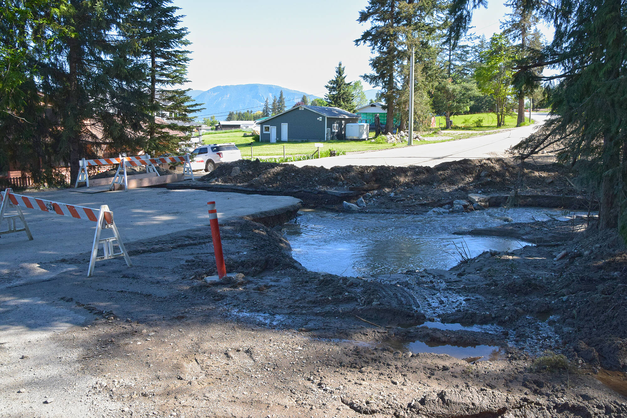
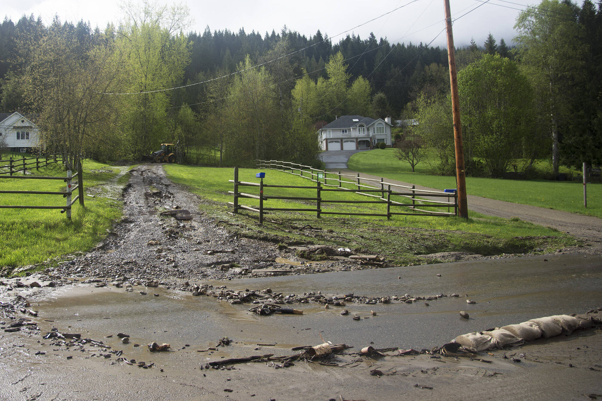
In Salmon Arm, the city has had to repair washouts of Foothill Road both in 2015 and 2017.
Regarding the incident in February 2015, Rob Niewenhuizen, the city’s director of engineering and public works, said, “One of the contributing factors may have been a plugged culvert on thse forest service road which is located above the Mt. Ida Cemetery.
“This resulted in a concentration of runoff water being diverted though the forest and onto Foothill Road resulting in a washout of the road base.”
He said the repairs cost about $300,000, but the city received some provincial disaster financial assistance.
The second recent washout on Foothill Road occurred in May 2017 during the annual freshet.
“Again we believe that a forest service road culvert on Mt. Ida was frozen and when the spring melt happened it caused a dam behind the road and eventually washed out causing somewhat of a debris flow down in what is known as Hobson Creek. The heavy flows caused the creek to jump its banks, resulting in a culvert on Foothill Road being washed out,” Niewenhiuzen said.
He noted the cost to replace the culvert and repair the section of roadway was about $120,000.
A provincial map of the 2017 washout shows the resource road was identified as a status logging road. VanBuskirk stated if this happens on a status road, it emphasizes the risks from roads that have been abandoned.
Read more: Salmon Arm roadways damaged by water and landslides
Read more: Final Foothill Road repairs in August
“When you lose control of water and it goes into areas where it hasn’t been before – that’s where you have a reasonable potential to trigger landslides,” VanBuskirk said.
Occasionally loss of tree cover and other causes can be triggers, he added, but in most cases it’s roads and road accesses.
Other causes are usually a bit slower to react, but “drainage diversion can trigger a problem in a heartbeat,” VanBuskirk said.
“Unfortunately when big storms do come through, it’s easy for the media and it’s easy for parties involved to just blame the storm and blame climate change… but not go up and look at what actually caused the landslide in the first place. It’s easy to blame the weather because we know the water did trigger the landslide,” he said, emphasizing he wants non-status resource roads addressed properly.
“There seems to be a lack of political will to go out and address these things.”
Both VanBuskirk and Friele explain their professional ethics call for engineers and geoscientists to set public safety and risks to the environment as priorities.
Professional ethics “and just from being human I guess” are motivations, said Friele, “so speaking out on these issues is important from that point of view.”
martha.wickett@saobserver.net
Like us on Facebook and follow us on Twitter
and subscribe to our daily newsletter.
BC FloodfloodinginfrastructureSalmon Arm


