A 1,000-hectare coordinated cross-border planned ignition will be used as part of efforts to battle the Eagle Bluff Wildfire near Osoyoos.
The BC Wildfire Service Incident Management Team managing the Eagle Bluff wildfire on the Canadian side of the border is coordinating response efforts with the U.S Incident Management Team on the controlled burn.
The plan is to go from Nighthawk Road and follow existing road networks into Canada, before tying it into Frank Lake and along Highway 3 according to the BC Wildfire Service, in order to remove unburnt fuel and contain the fire’s western flank.
A combination of hand and aerial ignitions with support from ground personnel, structure protection personnel and aerial resources began the burn in the evening of Aug. 1, with plans to carry on through the day on Aug. 2 if conditions allow.
The latest size estimate for the fire has it at least 3,044 hectares in size on the Canadian side of the border, and at least 6,364 hectares south of the border.
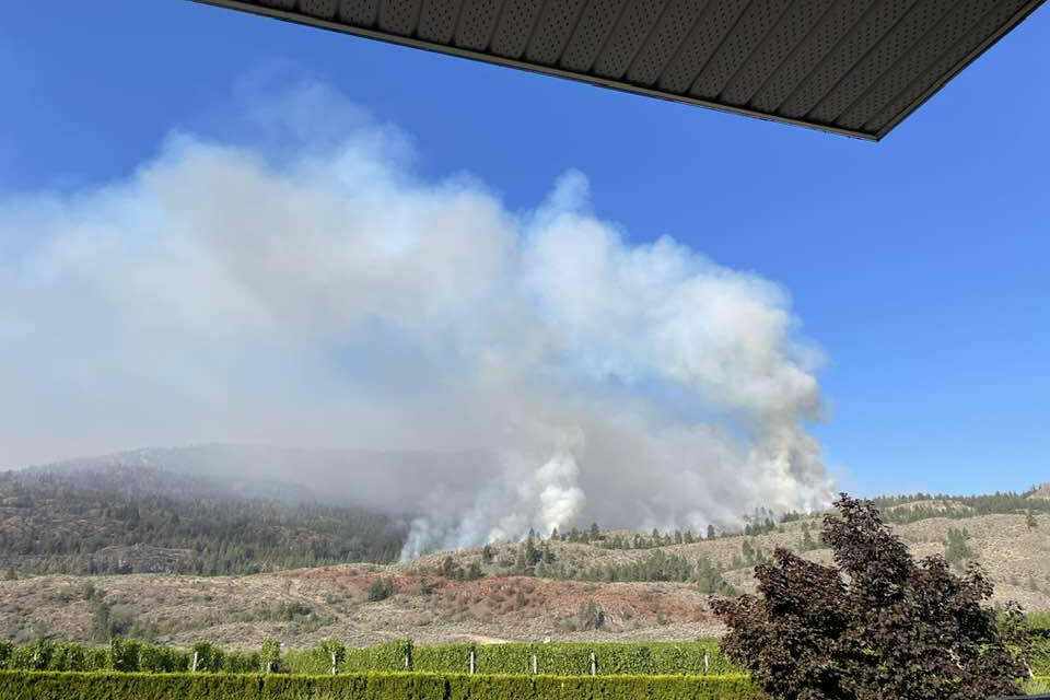
The wildfire, that started July 29, seemed to flare up again both on the eastern and western flanks on Tuesday night, with helicopters and air bombers working very hard all day.
On Tuesday, some Osoyoos residents got together to show their thanks to the hard work of the pilots in the air battling the fire. They made a large sign saying thank you to show their appreciation for their tireless work on the fire. Carla Martinez posted the video.
Evacuation orders are still in place in the Regional District of Okanagan Similkameen and Town of Osoyoos for 191 properties and alerts remain for 969 properties.
Areas under order including the town’s industrial park, all properties south of Highway 3 from the Town of Osoyoos boundaries to Nighthawk Road in RDOS Electoral Area “B”, and parts of Electoral Areas “A” and “B” including the Kilpoola and Spotted Lake areas south of Highway 3.
The fire is currently burning in steep and rocky terrain that is risky for ground personnel and heavy equipment. The forecast is expecting warm and dry conditions in the area this afternoon, along with light to moderate gusty winds from the south.
READ MORE: Eagle Bluff Wildfire grows to more than 3,000 hectares in Osoyoos
To report a typo, email: editor@pentictonwesternnews.com.
Don’t miss a single story and get them delivered directly to your inbox. Sign up today for the Penticton Western News Newsletter.
@PentictonNews
newstips@pentictonwesternnews.com
Like us on Facebook and follow us on Twitter.
