bcwildfire

The Flood Falls Trail wildfire is now estimated to be 545 hectares according to BC Wildfire Service (Richard Haworth/Facebook)

UPDATE: Evacuation order no longer in effect for the Flood Falls Trail wildfire

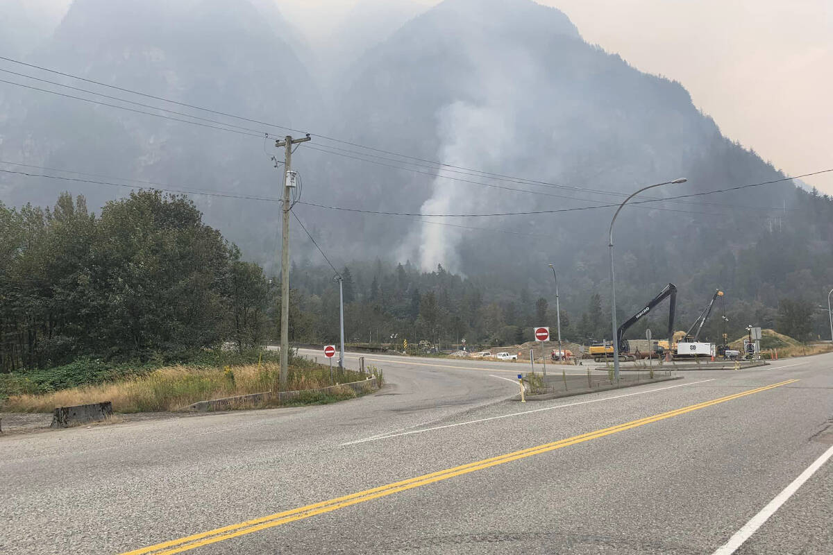
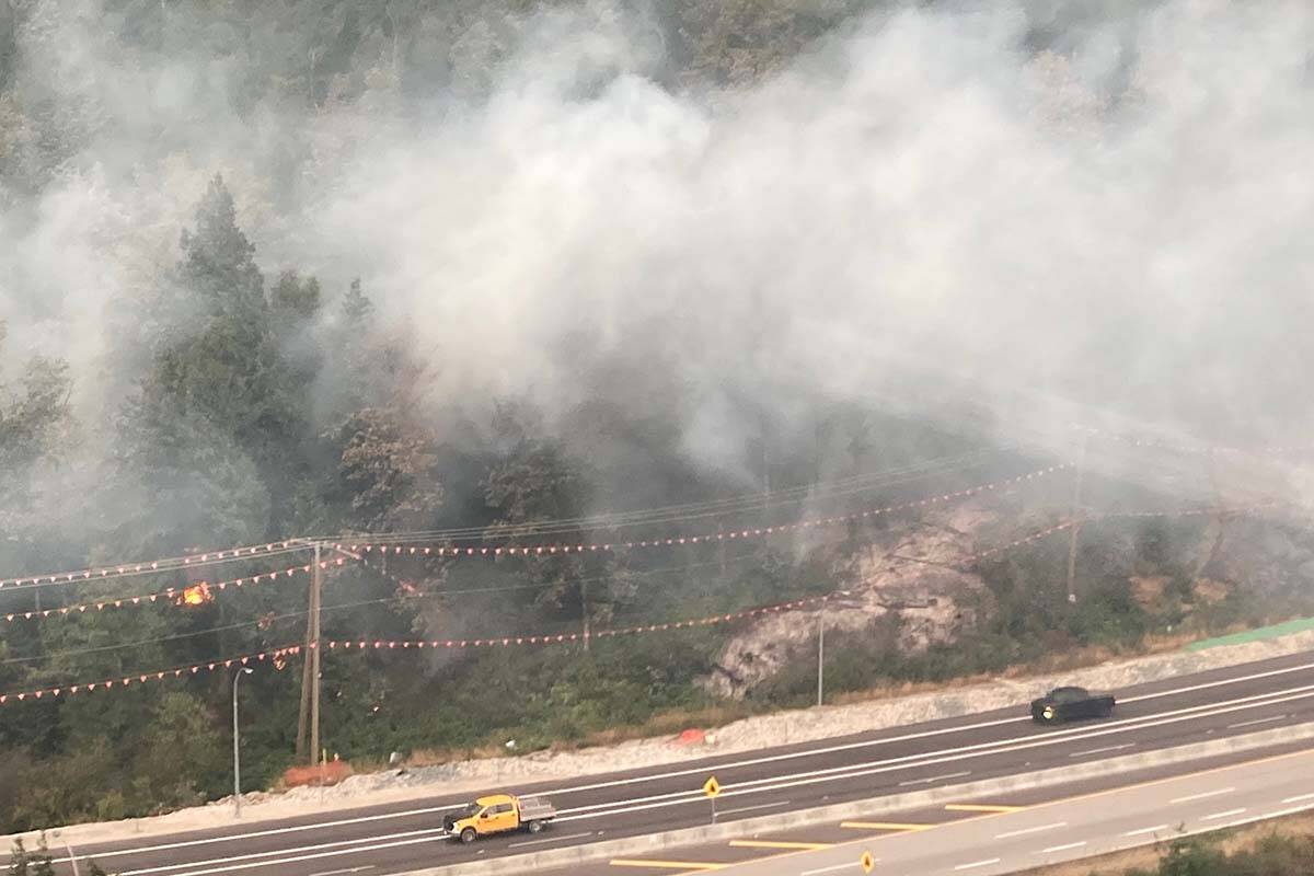
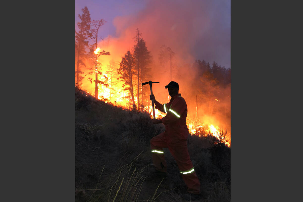
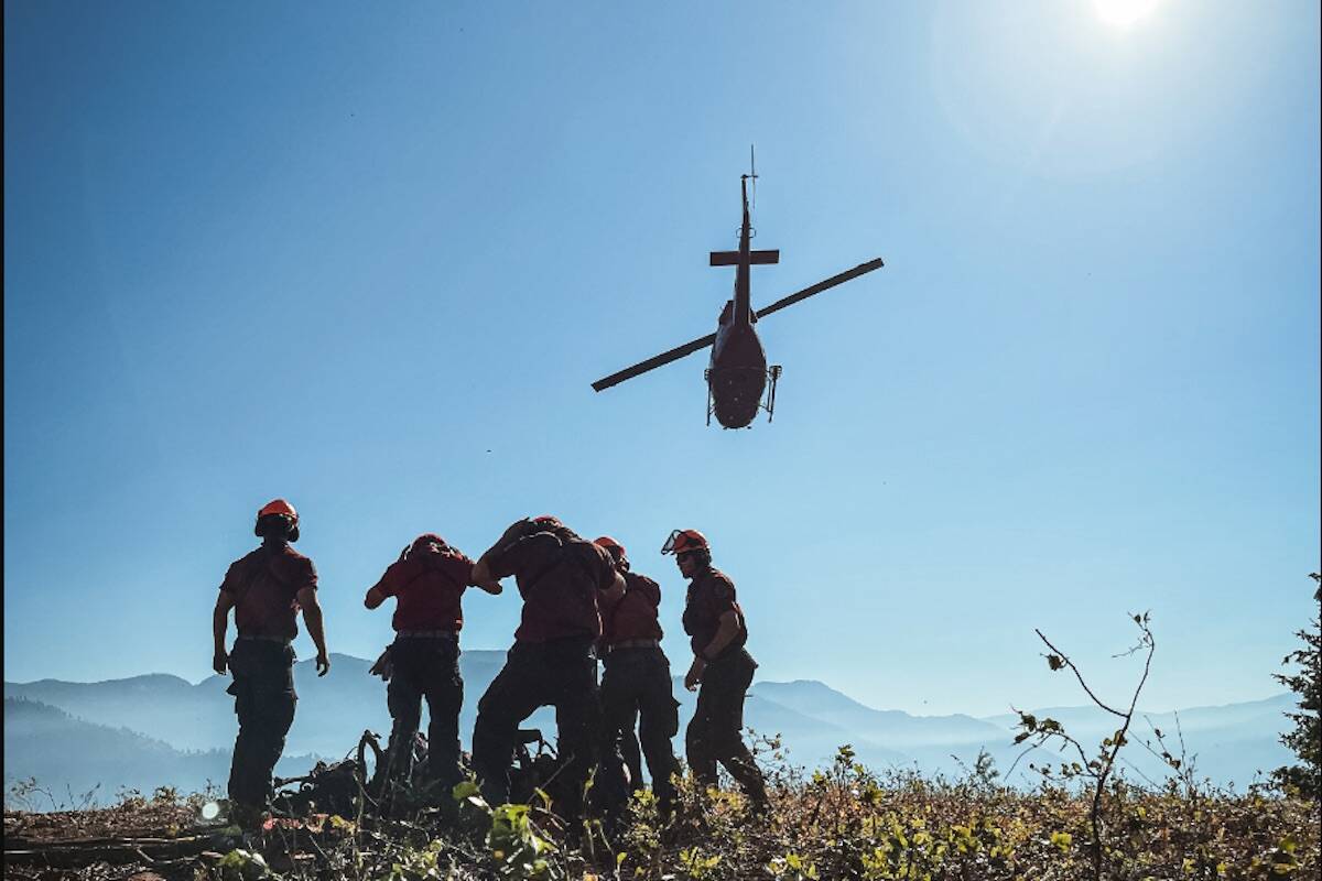
8 helicopters now fighting the wildfire at Flood Falls Trail

The Flood Falls Trail wildfire is now estimated to be 545 hectares according to BC Wildfire Service (Richard Haworth/Facebook)
Highway 1 eastbound through Hope is closed Sunday (Sept. 11) as the Flood Falls Trail wildfire continues to grow. (Photo courtesy of BC Wildfire Service)

UPDATE: Highway 1 eastbound closed as Flood Falls Trail wildfire grows to 458 hectares

All eastbound traffic between Chilliwack and Hope detoured to Highway 7 and Highway 9

Highway 1 eastbound through Hope is closed Sunday (Sept. 11) as the Flood Falls Trail wildfire continues to grow. (Photo courtesy of BC Wildfire Service)
Smoke from a wildfire near Hope taken at 5 p.m. on Sept. 9, 2022. (William Snow photo)

Air quality at ‘very high risk’ in Eastern Fraser Valley due to multiple fires burning

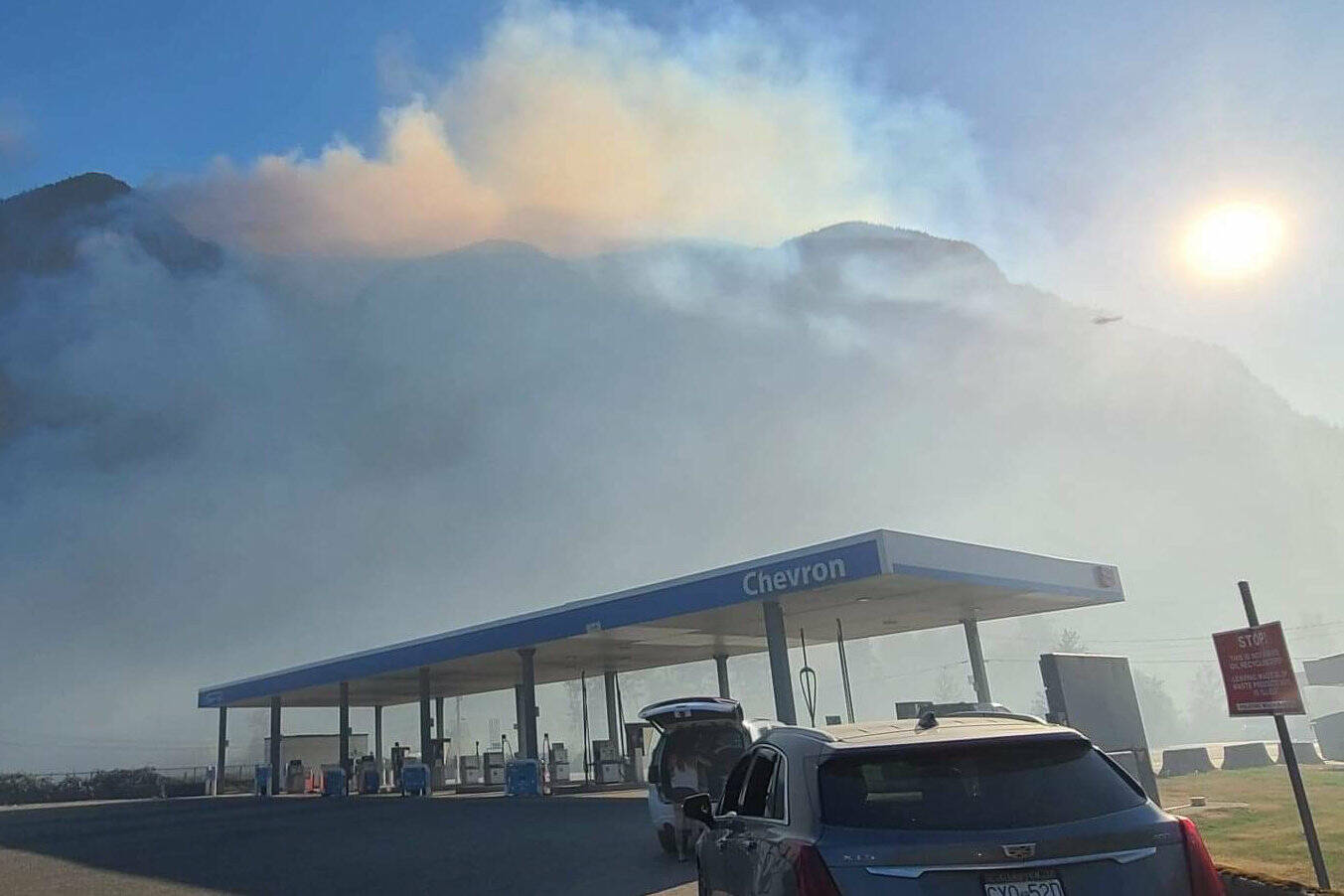
AQ advisories issued for entire Lower Mainland due to fires in Vancouver, Hope, Manning and the U.S.

Smoke from a wildfire near Hope taken at 5 p.m. on Sept. 9, 2022. (William Snow photo)
Wildfire officials in British Columbia say they are working with BC Parks and the Transportation Ministry to prepare for the spread of a blaze that has already charred 19 square kilometres of bush in Manning provincial park, as shown in this recent handout image provide by the BC Wildfire Service. THE CANADIAN PRESS/HO-BC Wildfire Service

Crews keep close watch on one B.C. wildfire, as another delays school in northeast

Manning Park, Hudson’s Hope home to notable blazes

Wildfire officials in British Columbia say they are working with BC Parks and the Transportation Ministry to prepare for the spread of a blaze that has already charred 19 square kilometres of bush in Manning provincial park, as shown in this recent handout image provide by the BC Wildfire Service. THE CANADIAN PRESS/HO-BC Wildfire Service
In this June 11, 2019 file photo, firefighter Andrew Pettit walks among the flames during a prescribed fire in Cedar Grove at Kings Canyon National Park, Calif. (Brian Melley/The Associated Press)
The East Meadows Plateau wildfire is about 20 kilometres from the City of Kamloops. (Photo/BCWS Twitter)

Wildfire sparks just north of Kamloops

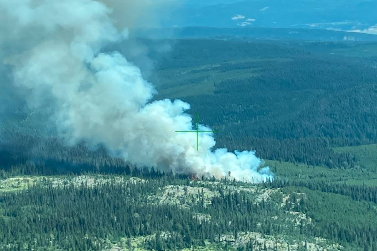
The fire is highly visible to Kamloops and the surrounding area

The East Meadows Plateau wildfire is about 20 kilometres from the City of Kamloops. (Photo/BCWS Twitter)
BC Wildfire Service crews mopping up in areas surrounding the Keremeos Creek wildfire. (BC Wildfire Service- Facebook)

Keremeos Creek blaze stable over the weekend

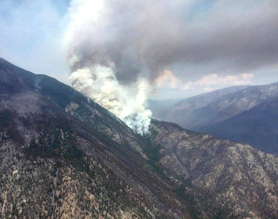
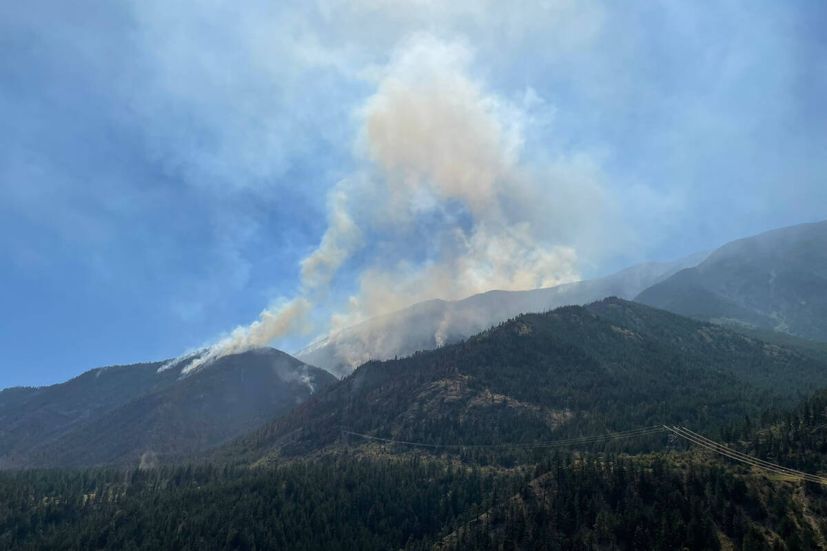
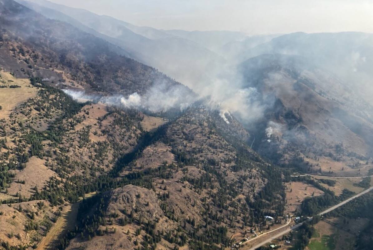
Keremeos wildfire behaviour remains relatively stable

BC Wildfire Service crews mopping up in areas surrounding the Keremeos Creek wildfire. (BC Wildfire Service- Facebook)
The BC Wildfire Service will organize ground crews and aerial support for the remaining Nohomin wildfire. (THE CANADIAN PRESS/HO-BC Wildfire Service)

Nohomin Creek blaze downgraded from wildfire of note

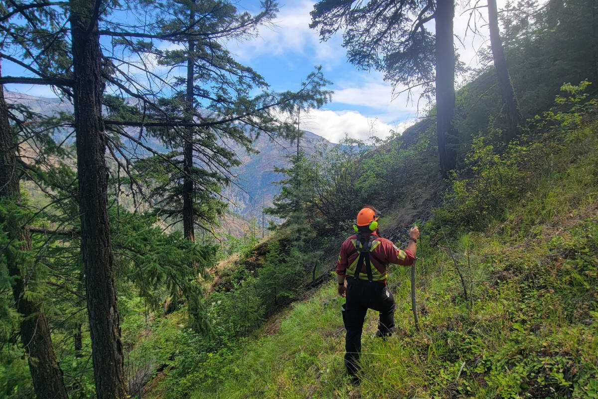
Remaining fire in Stein Valley Nlaka-pamux Heritage Park will be left to naturally extinguish

The BC Wildfire Service will organize ground crews and aerial support for the remaining Nohomin wildfire. (THE CANADIAN PRESS/HO-BC Wildfire Service)
Keremeos Creek Wildfire planned ignitions (BC Wildfire Service)

Fire fuelling forecast for Keremeos Creek wildfire, near Penticton

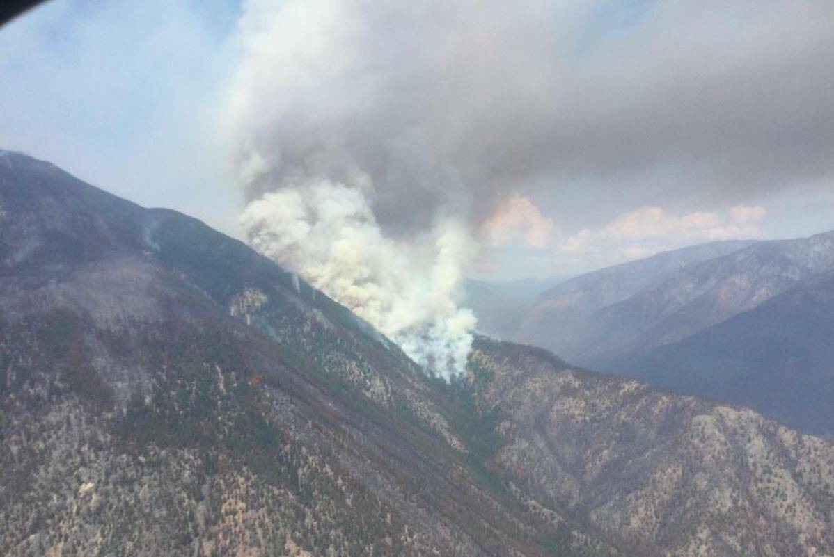
The Keremeos fire near Penticton is currently 5903 hectares in size.

Keremeos Creek Wildfire planned ignitions (BC Wildfire Service)
The Nohomin Creek wildfire near Lytton continues to burn, although evacuation alerts have been lifted. (Photo courtesy of BC Wildfire Service)

Nohomin Creek wildfire stable on most flanks

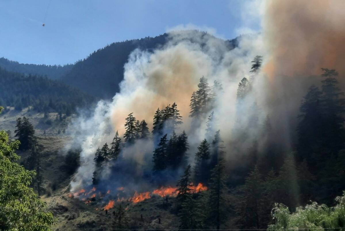
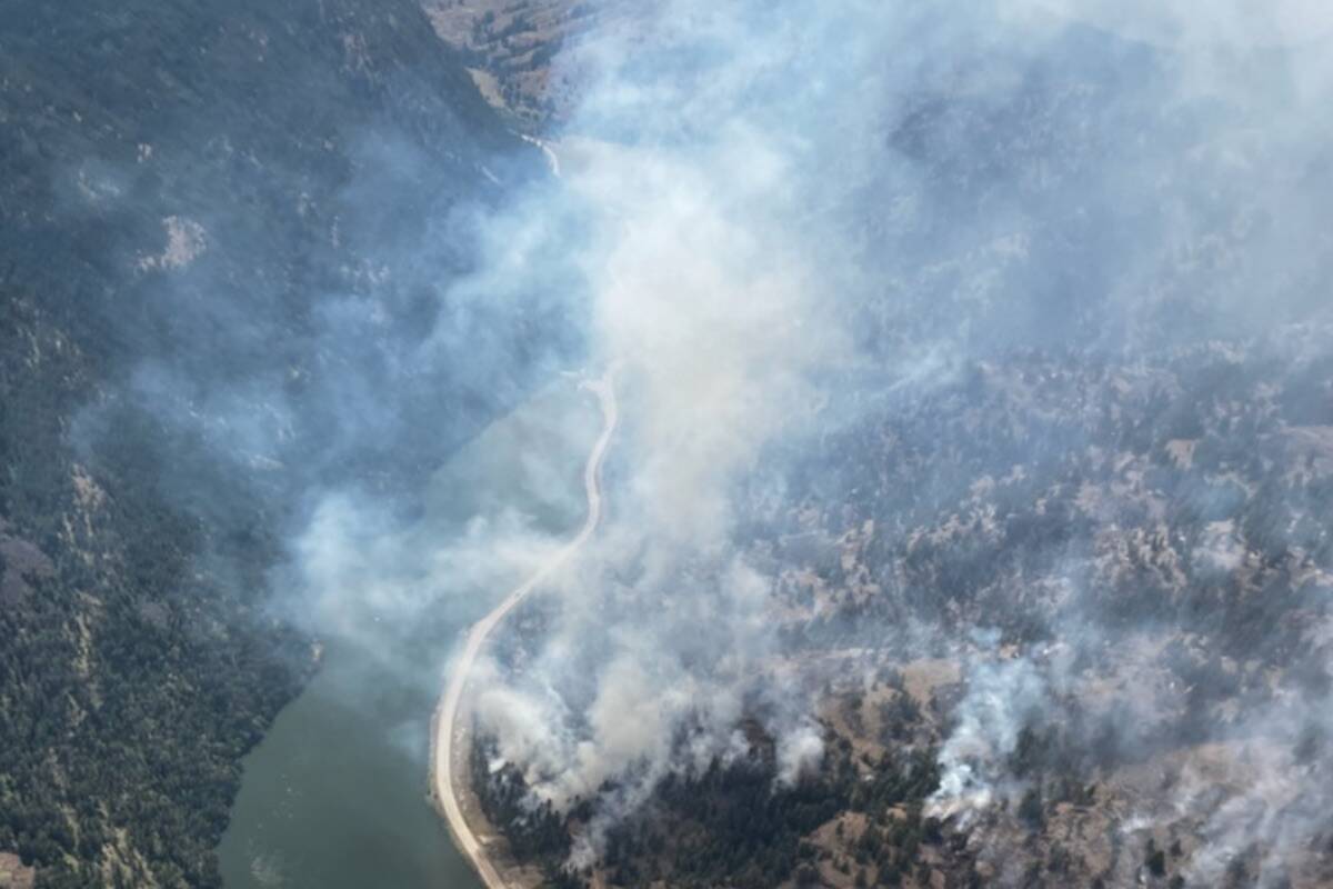
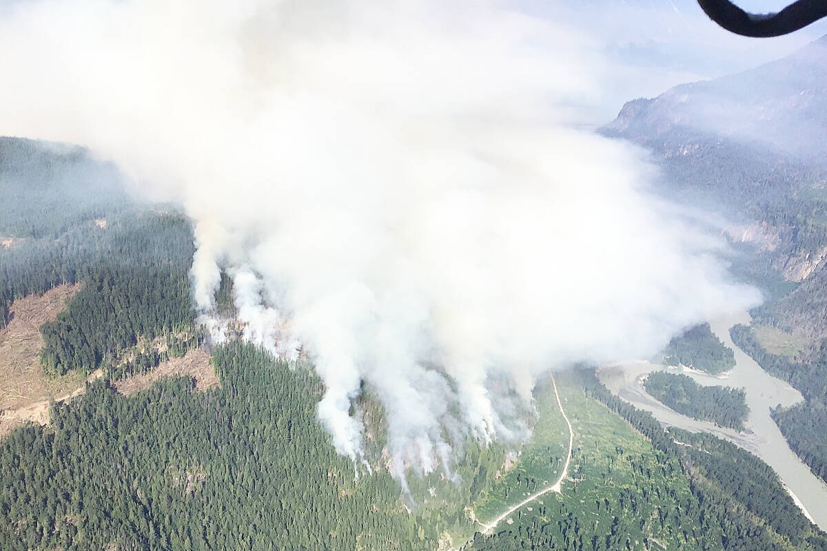
Blaze near Lytton has grown to an estimated 3,745 hectares

The Nohomin Creek wildfire near Lytton continues to burn, although evacuation alerts have been lifted. (Photo courtesy of BC Wildfire Service)
A northwest facing view of the Nohomin Creek wildfire, upslope from the Fraser River at the Seven Mile Creek. (BC Wildfire Service photo)

Cooler temps slow Nohomin Creek wildfire activity, but not out of the woods yet

Despite the cooler weather, the fire isn’t out of the woods yet with temperatures expecting to raise

A northwest facing view of the Nohomin Creek wildfire, upslope from the Fraser River at the Seven Mile Creek. (BC Wildfire Service photo)
Night time photos of Nohomin Creek wildfire, about two kilometres north of Lytton, B.C. July 14, 2022. (Facebook/Edith Loring Kuhanga)

Nohomin creek wildfire near Lytton slows with cooler weather

Burning conditions will likely return to what was experienced in late July with weekend heat

Night time photos of Nohomin Creek wildfire, about two kilometres north of Lytton, B.C. July 14, 2022. (Facebook/Edith Loring Kuhanga)
(BC Wildfire Services)
BC Wildfire Ground Crews (BC Wildfire Service)
(BC Wildfire Services)
A campfire ban will go into effect Aug. 4 in the Coastal Fire Centre, with the except of Haida Gwaii. (BCWS map)

Campfire ban ordered for Vancouver Island, Lower Mainland

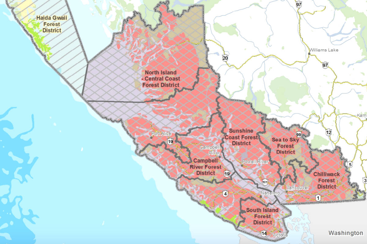
Ban comes into effect Thursday (Aug. 4)

  • Aug 3, 2022
A campfire ban will go into effect Aug. 4 in the Coastal Fire Centre, with the except of Haida Gwaii. (BCWS map)
Clay Smith, father, digging a trench to prevent encroachment of the fire (Caillum Smith/Preserved Light Photography)

Father-son duo fights South Okanagan wildfire to save their home

Their neighbour’s home was lost in the blaze

Clay Smith, father, digging a trench to prevent encroachment of the fire (Caillum Smith/Preserved Light Photography)
Crew member scouts for possible contingency lines ahead of the north flank of the fire. The fire is being managed by the Nohomin Creek wildfire crew. (BC Wildfire Service photo)

Lightning strike causes fire of note in Maria Creek

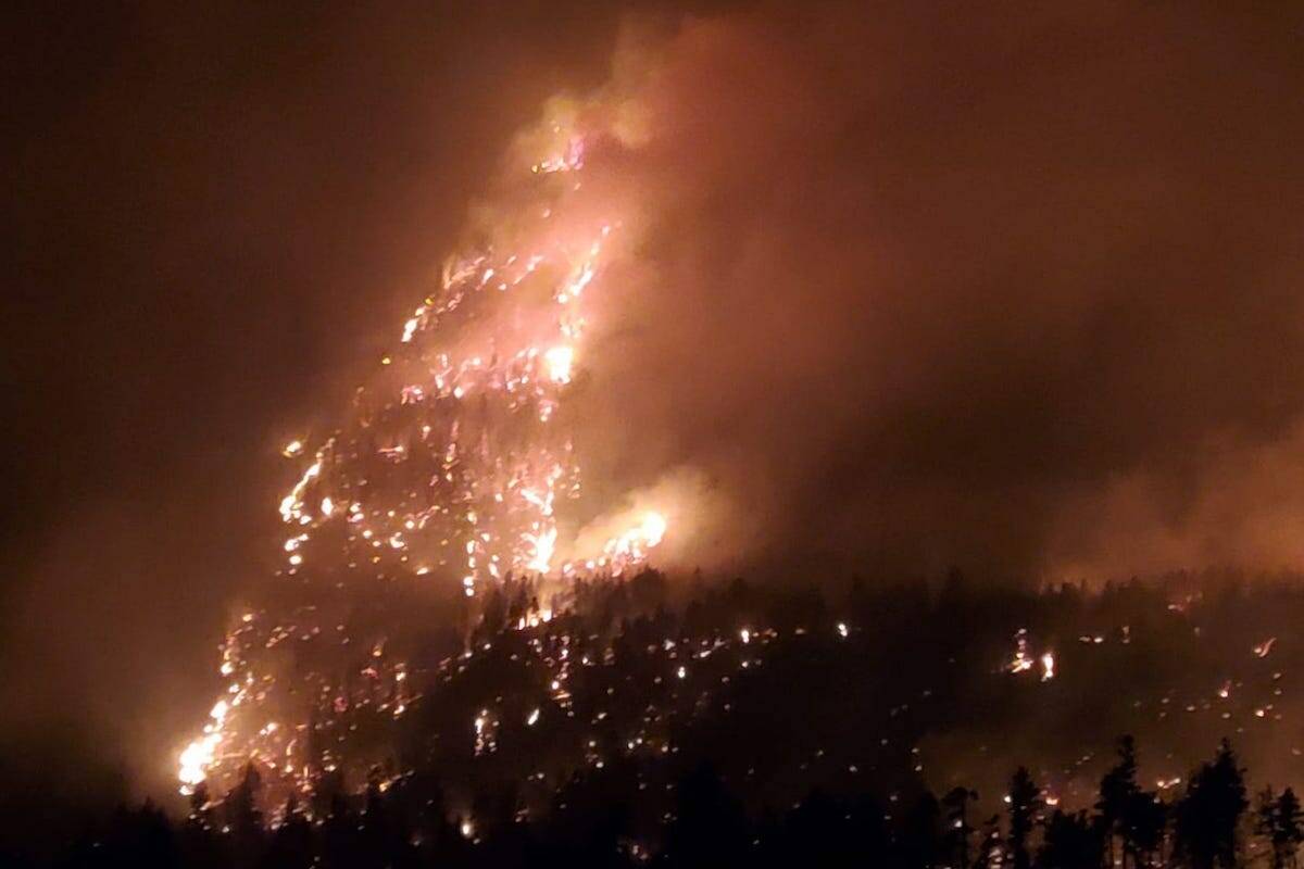
The “aggressive” fire is now 800ha

Crew member scouts for possible contingency lines ahead of the north flank of the fire. The fire is being managed by the Nohomin Creek wildfire crew. (BC Wildfire Service photo)
The Southgate River Fire is located at the northeastern tip of Bute Inlet on the B.C. mainland east of Campbell River. It is one of two fires burning in the area and is classified as out of control. BC Wildfire photo/Twitter

Two wildfires burning out of control at head of Bute Inlet on B.C.’s south coast

Coastal Fire Centre reports 208 ha and 16.5 ha fires are being managed as one

The Southgate River Fire is located at the northeastern tip of Bute Inlet on the B.C. mainland east of Campbell River. It is one of two fires burning in the area and is classified as out of control. BC Wildfire photo/Twitter
Dozens of firefighters and 11 helicopters continue to battle the Nohomin Creek blaze Aug. 2. (Courtesy of BC Wildfire Service)

Nohomin Creek wildfire fighters battle heat exhaustion as blaze slowly grows

The Lytton-area fire is suspected to be human caused, but is still under investigation

Dozens of firefighters and 11 helicopters continue to battle the Nohomin Creek blaze Aug. 2. (Courtesy of BC Wildfire Service)