flooding

Cattle graze on a farm on the Nicola River that was affected by flooding in November, west of Merritt, B.C., on March 23, 2022. A high streamflow advisory has been issued due to snowmelt above the North Thompson River in central British Columbia. Within the Nicola River, a streamflow advisory was issued because rain from last week is still moving through the watershed’s reservoirs. THE CANADIAN PRESS/Darryl Dyck

High streamflow advisory issued for rivers overwhelmed by November’s flooding in B.C.

Snowmelt above North Thompson will send a “pulse” of water downstream, significant rainfall not expected

Cattle graze on a farm on the Nicola River that was affected by flooding in November, west of Merritt, B.C., on March 23, 2022. A high streamflow advisory has been issued due to snowmelt above the North Thompson River in central British Columbia. Within the Nicola River, a streamflow advisory was issued because rain from last week is still moving through the watershed’s reservoirs. THE CANADIAN PRESS/Darryl Dyck
Sandbags being prepared in Smithers as the Bulkley River rises. (Marisca Bakker photo)

Residents of flood-prone areas in B.C. urged to be ready to leave at short notice

Up to 70 millimetres of rain could fall in some parts of the province between Thursday and Saturday

Sandbags being prepared in Smithers as the Bulkley River rises. (Marisca Bakker photo)
A wildfire burns in the mountains north of Lytton on July 1, 2021. According to a survey 2022 survey by BCAA, most British Columbians fear more extreme weather events. (Darryl Dyck/The Canadian Press via AP, File)

85% of British Columbians fear another extreme weather event, but few are prepared: survey

Almost half of survey respondents taking “wait-and-see” approach, BCAA found

A wildfire burns in the mountains north of Lytton on July 1, 2021. According to a survey 2022 survey by BCAA, most British Columbians fear more extreme weather events. (Darryl Dyck/The Canadian Press via AP, File)
The ferry at Usk east of Terrace has been pulled from service on the Skeena River for now because of rising water levels. (Photo courtesy the Ministry of Transportation and Infrastructure)

High streamflow advisory for B.C.’s lower Fraser River, snowpack remains high

River Forecast Centre advisory applies to areas from Quesnel downstream to the ocean

The ferry at Usk east of Terrace has been pulled from service on the Skeena River for now because of rising water levels. (Photo courtesy the Ministry of Transportation and Infrastructure)
B.C. Minister of Transportation and Infrastructure Rob Fleming views flooding and mudslide repair and clean up progress on the Coquihalla Highway northeast of Hope, B.C., Friday, Dec. 10, 2021. Emergency officials say as many as 20 buildings are flooded in three northwestern British Columbia communities but a break in the weather has slowed rising waterways across the region and evacuation orders are set to be updated. THE CANADIAN PRESS/Darryl Dyck

Forecast centre says river in northeast B.C. could surge to flood conditions

Break in the weather has slowed rising waterways however, across the northwest region

B.C. Minister of Transportation and Infrastructure Rob Fleming views flooding and mudslide repair and clean up progress on the Coquihalla Highway northeast of Hope, B.C., Friday, Dec. 10, 2021. Emergency officials say as many as 20 buildings are flooded in three northwestern British Columbia communities but a break in the weather has slowed rising waterways across the region and evacuation orders are set to be updated. THE CANADIAN PRESS/Darryl Dyck
Floodwaters cover a road after water began to recede at Everglades Resort on Hatzic Lake near Mission, B.C., on Sunday, December 5, 2021. Evacuation orders have been issued for three small communities in northwestern British Columbia as the flood risk rises across the region. THE CANADIAN PRESS/Darryl Dyck

‘15-20 structures’ flooded in northwest B.C., as flood risk continues

Officials say break in the weather has slowed the rise of the Skeena River

Floodwaters cover a road after water began to recede at Everglades Resort on Hatzic Lake near Mission, B.C., on Sunday, December 5, 2021. Evacuation orders have been issued for three small communities in northwestern British Columbia as the flood risk rises across the region. THE CANADIAN PRESS/Darryl Dyck

Evacuations, local state of emergency in northwest B.C., as flood risk rises

Flood danger dropping for much of the southern Interior, from the Cariboo Plateau to the US border

Floodwaters cover a road after water began to recede at Everglades Resort on Hatzic Lake near Mission, B.C., on Sunday, December 5, 2021. Evacuation orders have been issued for three small communities in northwestern British Columbia as the flood risk rises across the region. THE CANADIAN PRESS/Darryl Dyck
A property affected by November flooding of the Nicola River is seen along Highway 8 on the Shackan Indian Band, northwest of Merritt, B.C., Thursday, March 24, 2022. British Columbia officials are closing some roadways as forecasted heavy rainfall and warming weather increases the risk of flooding in parts of the province’s north and Interior. THE CANADIAN PRESS/Darryl Dyck

Communities across B.C. brace for potential flooding this weekend and next week

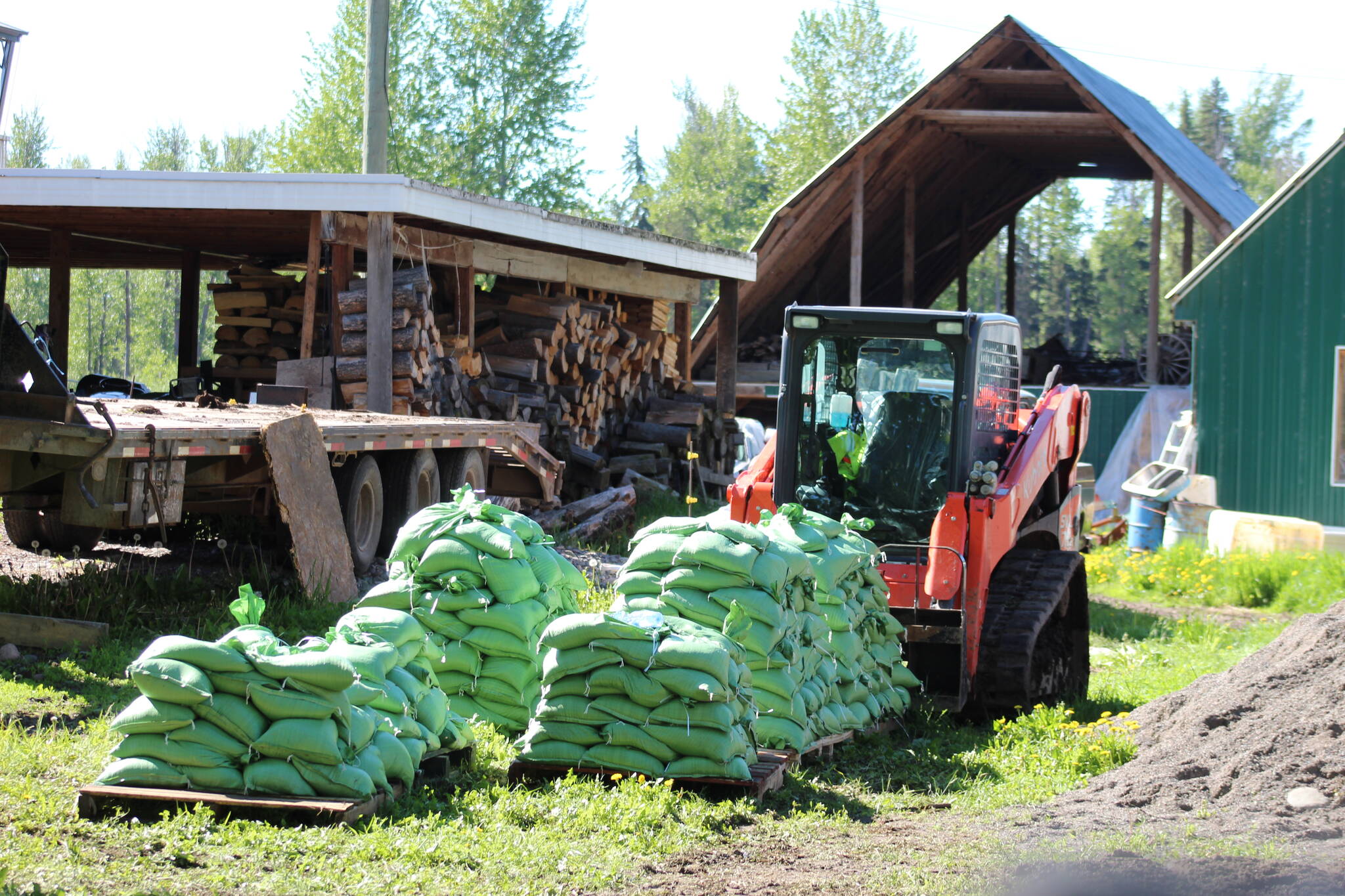
A late spring thaw and remaining snowpacks mean warm weather could trigger disaster

A property affected by November flooding of the Nicola River is seen along Highway 8 on the Shackan Indian Band, northwest of Merritt, B.C., Thursday, March 24, 2022. British Columbia officials are closing some roadways as forecasted heavy rainfall and warming weather increases the risk of flooding in parts of the province’s north and Interior. THE CANADIAN PRESS/Darryl Dyck
A mudflow cuts across the access road to a property on Highway 8 east of Spences Bridge on June 3, 2022. Heavy rain and the potential for debris flows has prompted the closure of Highway 1 between Spences Bridge and Lytton. (Photo credit: Mavourneen Varcoe-Ryan)

Highway 1 closed between Lytton and Spences Bridge as proactive measure

Highway will remain closed until the morning of June 4 due to the potential for debris flows

A mudflow cuts across the access road to a property on Highway 8 east of Spences Bridge on June 3, 2022. Heavy rain and the potential for debris flows has prompted the closure of Highway 1 between Spences Bridge and Lytton. (Photo credit: Mavourneen Varcoe-Ryan)
Trucks haul loads of rock on a section of Highway 8 along the Nicola River, which had to be rebuilt after it was washed away during November flooding affecting the Shackan Indian Band, northwest of Merritt, B.C., on Thursday, March 24, 2022. THE CANADIAN PRESS/Darryl Dyck

Evacuation alerts, flood watch, stream advisories as B.C. braces for rain, snow melt

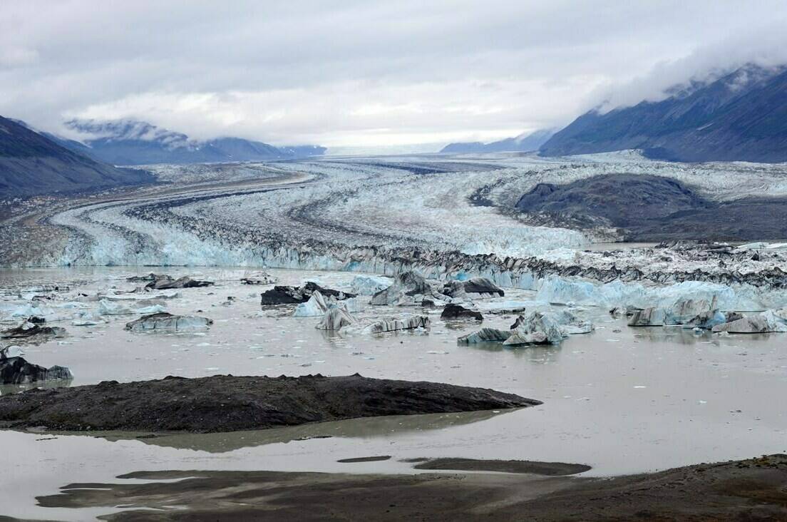
Concern persists above-average temperatures could cause heavy snowpacks to melt rapidly

Trucks haul loads of rock on a section of Highway 8 along the Nicola River, which had to be rebuilt after it was washed away during November flooding affecting the Shackan Indian Band, northwest of Merritt, B.C., on Thursday, March 24, 2022. THE CANADIAN PRESS/Darryl Dyck
Cattle graze on a farm on the Nicola River that was affected by flooding in November, west of Merritt, B.C., on Wednesday, March 23, 2022. The River Forecast Centre has issued high streamflow advisories covering parts of B.C.’s southern Interior as warming weather causes snowmelt and rising waters, while similar advisories remain in place across much of northern B.C. THE CANADIAN PRESS/Darryl Dyck

Parts of B.C. Interior under high streamflow advisories with rain in the forecast

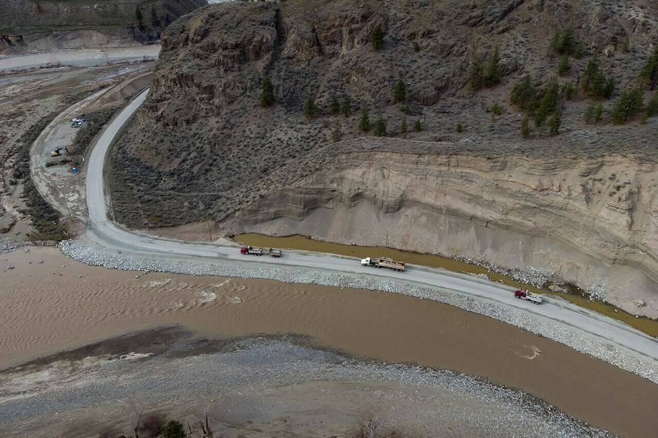
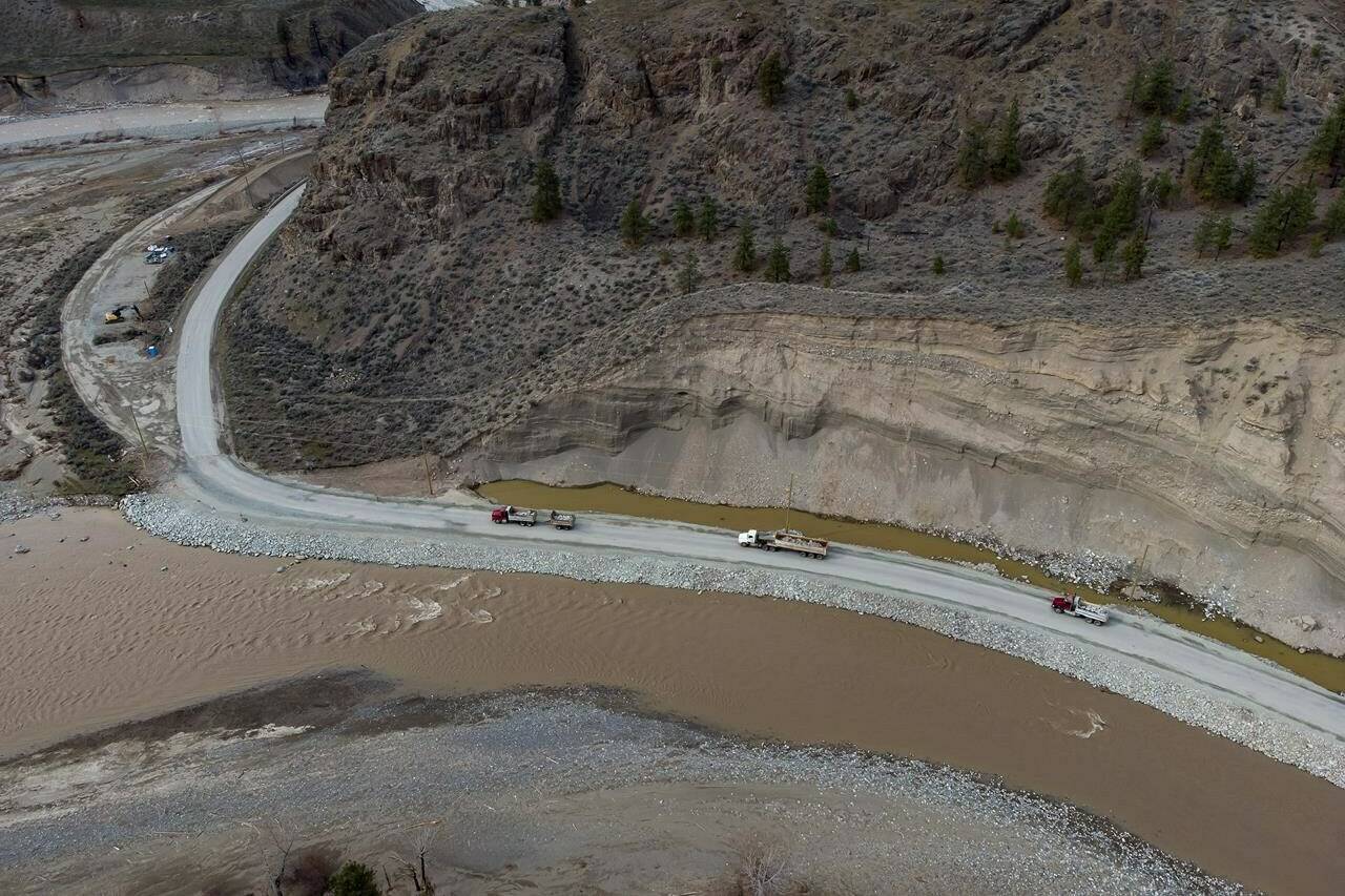
Latest advisories cover the Nicola River near Spences Bridge and the Coldwater River at Merritt

Cattle graze on a farm on the Nicola River that was affected by flooding in November, west of Merritt, B.C., on Wednesday, March 23, 2022. The River Forecast Centre has issued high streamflow advisories covering parts of B.C.’s southern Interior as warming weather causes snowmelt and rising waters, while similar advisories remain in place across much of northern B.C. THE CANADIAN PRESS/Darryl Dyck
People walk by the steam clock in Gas Town in downtown Vancouver, B.C., Tuesday, December, 31, 2019. Environment Canada warns prolonged rains will drench parts of northern B.C. over the weekend, raising the potential for localized flooding. THE CANADIAN PRESS/Jonathan Hayward

Environment Canada warns of heavy rain for parts of northern B.C., flood watch posted

Rainfall warnings issued for North and South Peace River regions

People walk by the steam clock in Gas Town in downtown Vancouver, B.C., Tuesday, December, 31, 2019. Environment Canada warns prolonged rains will drench parts of northern B.C. over the weekend, raising the potential for localized flooding. THE CANADIAN PRESS/Jonathan Hayward
Flood waters surround a farm in Abbotsford, B.C., Tuesday, Nov. 23, 2021. (THE CANADIAN PRESS/Jonathan Hayward)

Province extends deadline for flood-recovery help for farmers

Farmers now have two extra months to start submitting costs for cleanup and repairs

Flood waters surround a farm in Abbotsford, B.C., Tuesday, Nov. 23, 2021. (THE CANADIAN PRESS/Jonathan Hayward)
Flooding is shown in Hay River, N.W.T., on Wednesday, May 11, 2022. About 3,500 residents have been ordered to evacuate a town in the Northwest Territories as volatile water levels never before experienced in some areas cause extensive flooding and damage. People in Hay River, on the south shore of Great Slave Lake just north of the Alberta-N.W.T. boundary, were told late Wednesday to get to higher ground, travel to Yellowknife or register at the town’s community centre. THE CANADIAN PRESS/HO - Caitrin Pilkington, Cabin Radio

Residents who fled flooded N.W.T town can return; some services might be unavailable

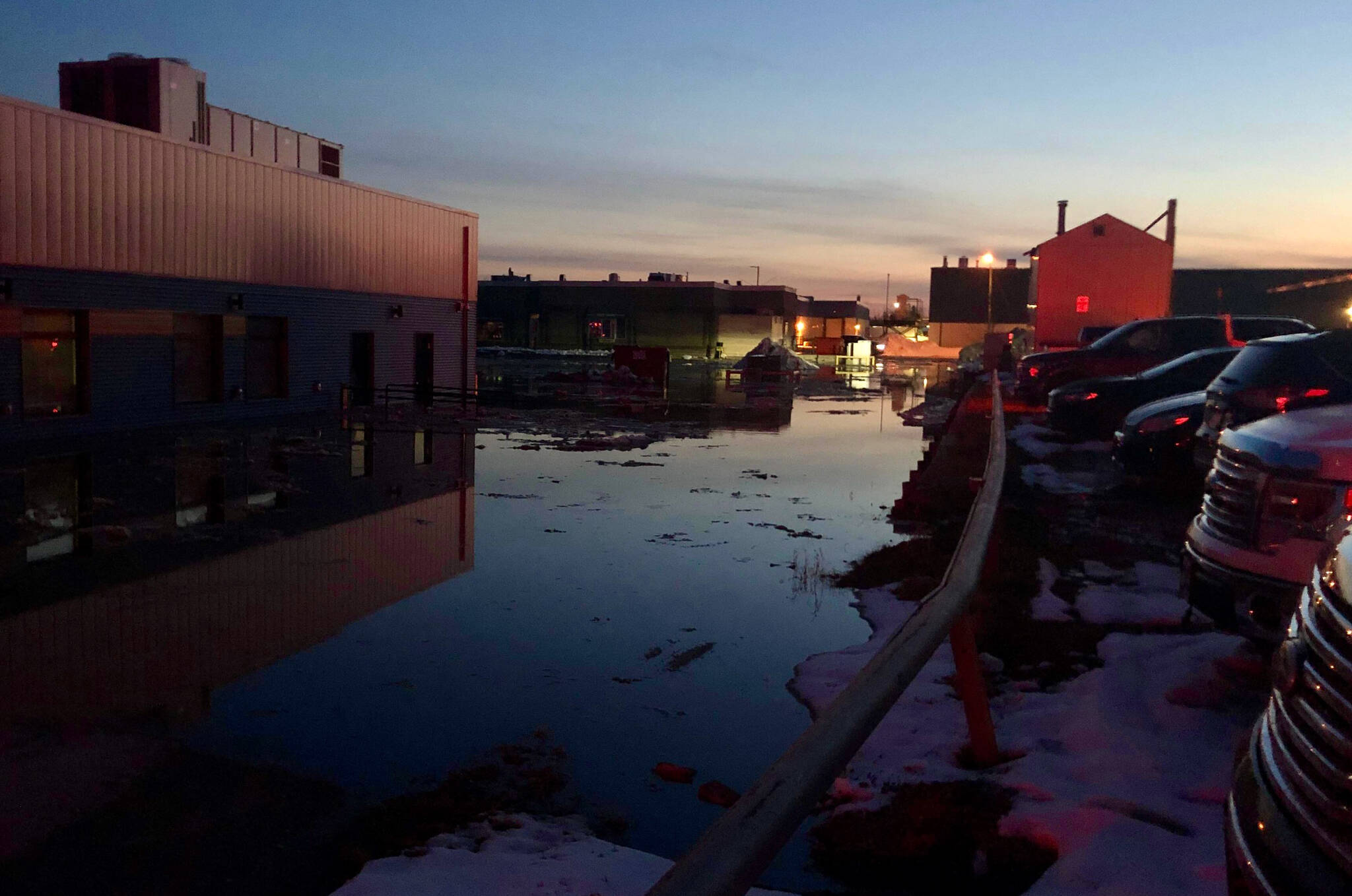
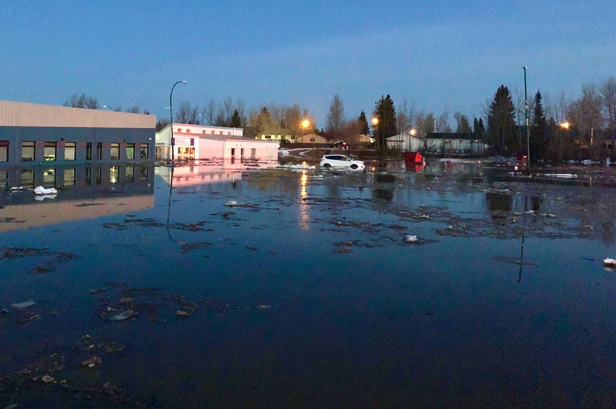
Hay River is an important transportation and communications centre

Flooding is shown in Hay River, N.W.T., on Wednesday, May 11, 2022. About 3,500 residents have been ordered to evacuate a town in the Northwest Territories as volatile water levels never before experienced in some areas cause extensive flooding and damage. People in Hay River, on the south shore of Great Slave Lake just north of the Alberta-N.W.T. boundary, were told late Wednesday to get to higher ground, travel to Yellowknife or register at the town’s community centre. THE CANADIAN PRESS/HO - Caitrin Pilkington, Cabin Radio

Heavy flooding forces residents of Northwest Territories town from their homes

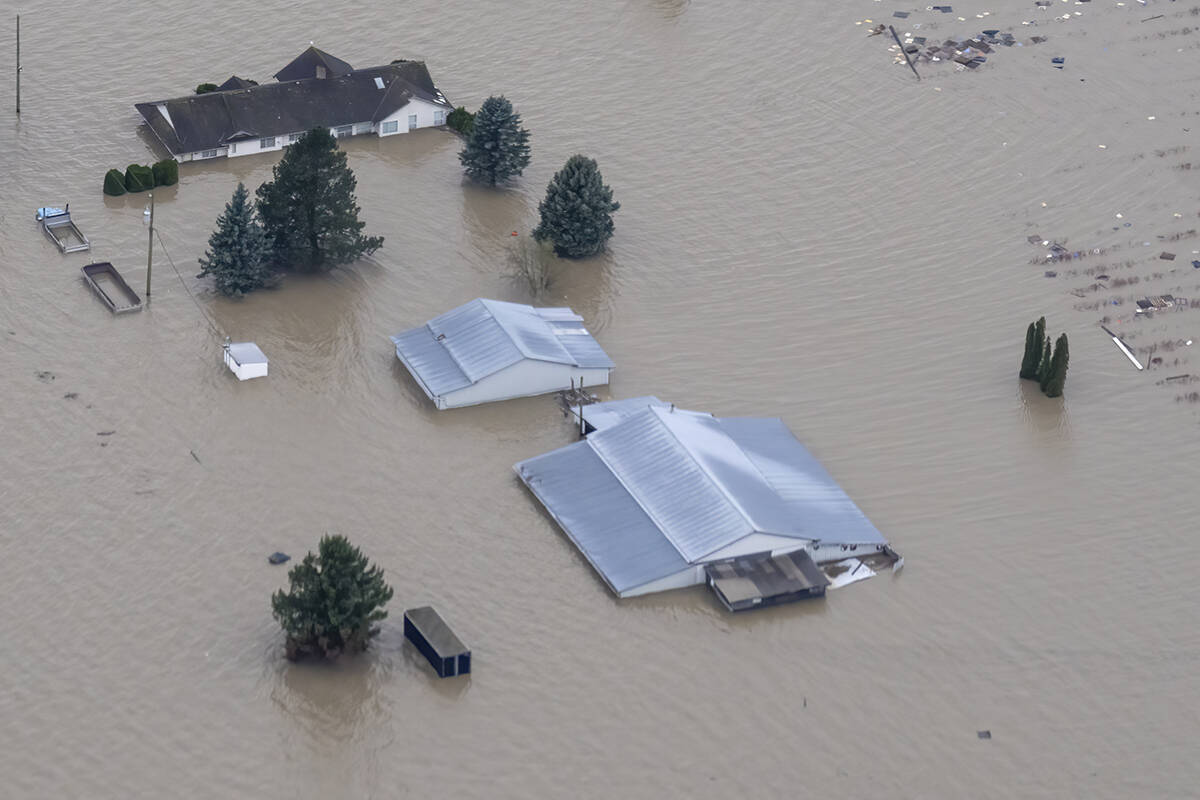
Never-before-experienced high waters in Hay River forces evacuation

Flooding is shown in Hay River, N.W.T., on Wednesday, May 11, 2022. About 3,500 residents have been ordered to evacuate a town in the Northwest Territories as volatile water levels never before experienced in some areas cause extensive flooding and damage. People in Hay River, on the south shore of Great Slave Lake just north of the Alberta-N.W.T. boundary, were told late Wednesday to get to higher ground, travel to Yellowknife or register at the town’s community centre. THE CANADIAN PRESS/HO - Caitrin Pilkington, Cabin Radio
Lowell Glacier in Kluane National Park, Yukon on Friday, Aug. 26, 2011. The senior hydrologist with Yukon’s Department of Environment says there is a concern for flooding with record-high snowpacks in many of the basins the territory monitors. THE CANADIAN PRESS/Sean Kilpatrick

Yukon hydrologist concerned about flood risk after cold April, record snowpacks

Rapid warming and significant rain would cause water levels in rivers to rise

Lowell Glacier in Kluane National Park, Yukon on Friday, Aug. 26, 2011. The senior hydrologist with Yukon’s Department of Environment says there is a concern for flooding with record-high snowpacks in many of the basins the territory monitors. THE CANADIAN PRESS/Sean Kilpatrick
Minister of Environment and Climate Change Strategy, George Heyman (gold coat), Fin Donnelly, parliamentary secretary for Fisheries and Aquaculture, and others plant trees at Hooge Wetlands in Chilliwack on Thursday, April 21, 2022. (Jenna Hauck/ Chilliwack Progress)

Chilliwack’s Hooge wetlands score a victory for natural flood defence

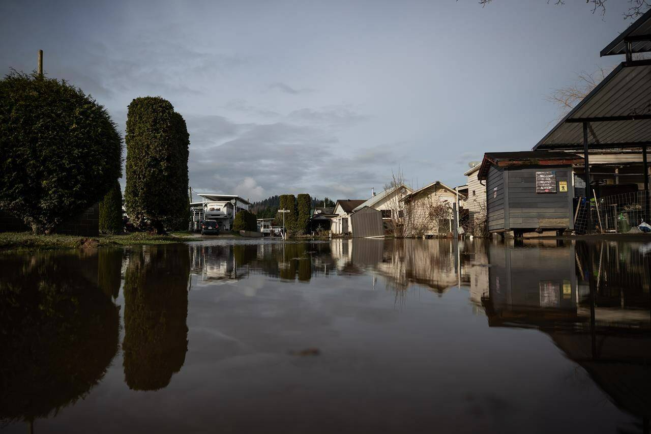
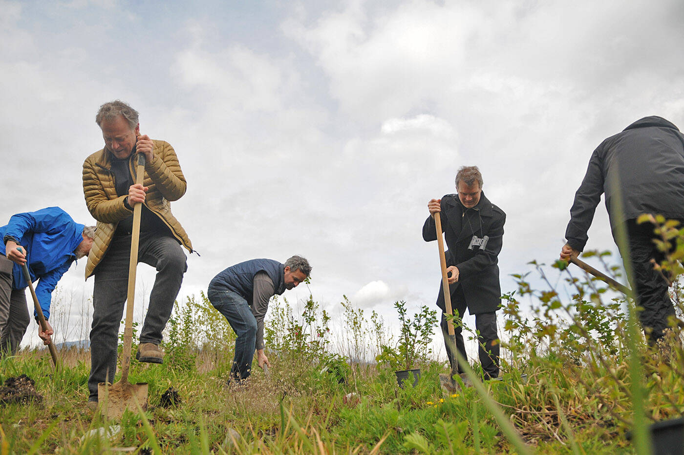
The newly-created wetlands soaked up excess stormwater during last November’s flooding

Minister of Environment and Climate Change Strategy, George Heyman (gold coat), Fin Donnelly, parliamentary secretary for Fisheries and Aquaculture, and others plant trees at Hooge Wetlands in Chilliwack on Thursday, April 21, 2022. (Jenna Hauck/ Chilliwack Progress)
Trucks haul loads of rock on a section of Highway 8 along the Nicola River that had to be rebuilt after it was washed away during November flooding on the Shackan Indian Band, northwest of Merritt, B.C., on Thursday, March 24, 2022. Major wildfires, droughts and mudslides last year dramatically altered the landscape, raising questions about the river’s ability to handle the spring thaw. THE CANADIAN PRESS/Darryl Dyck

B.C. communities struck by wildfires and floods brace for spring thaw

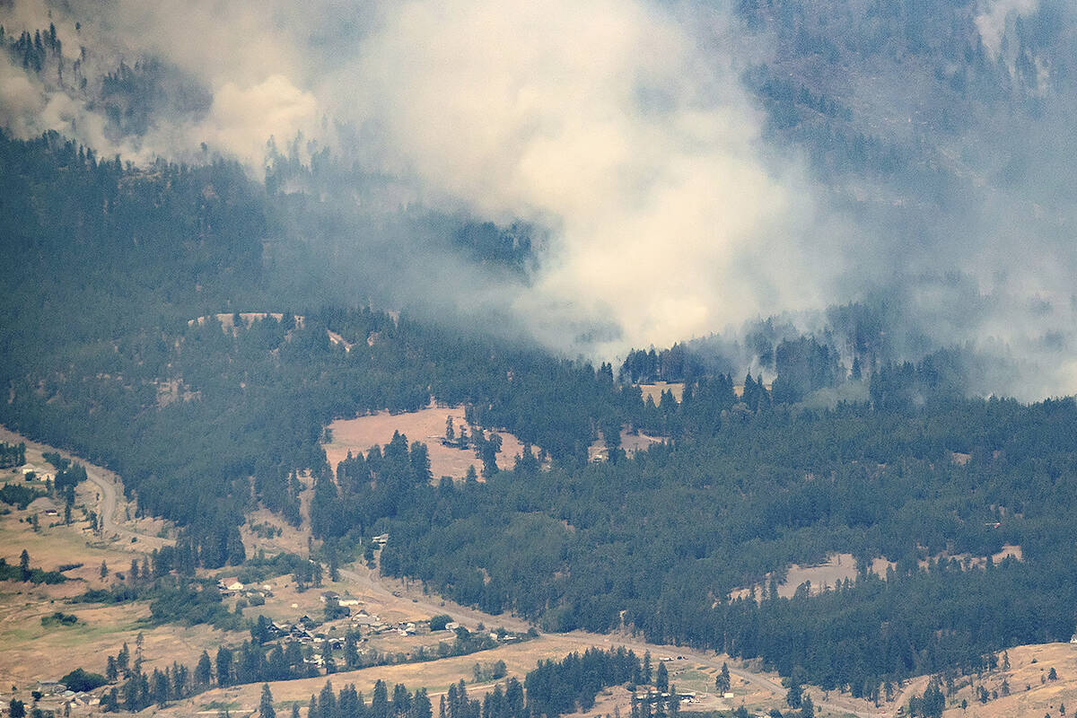
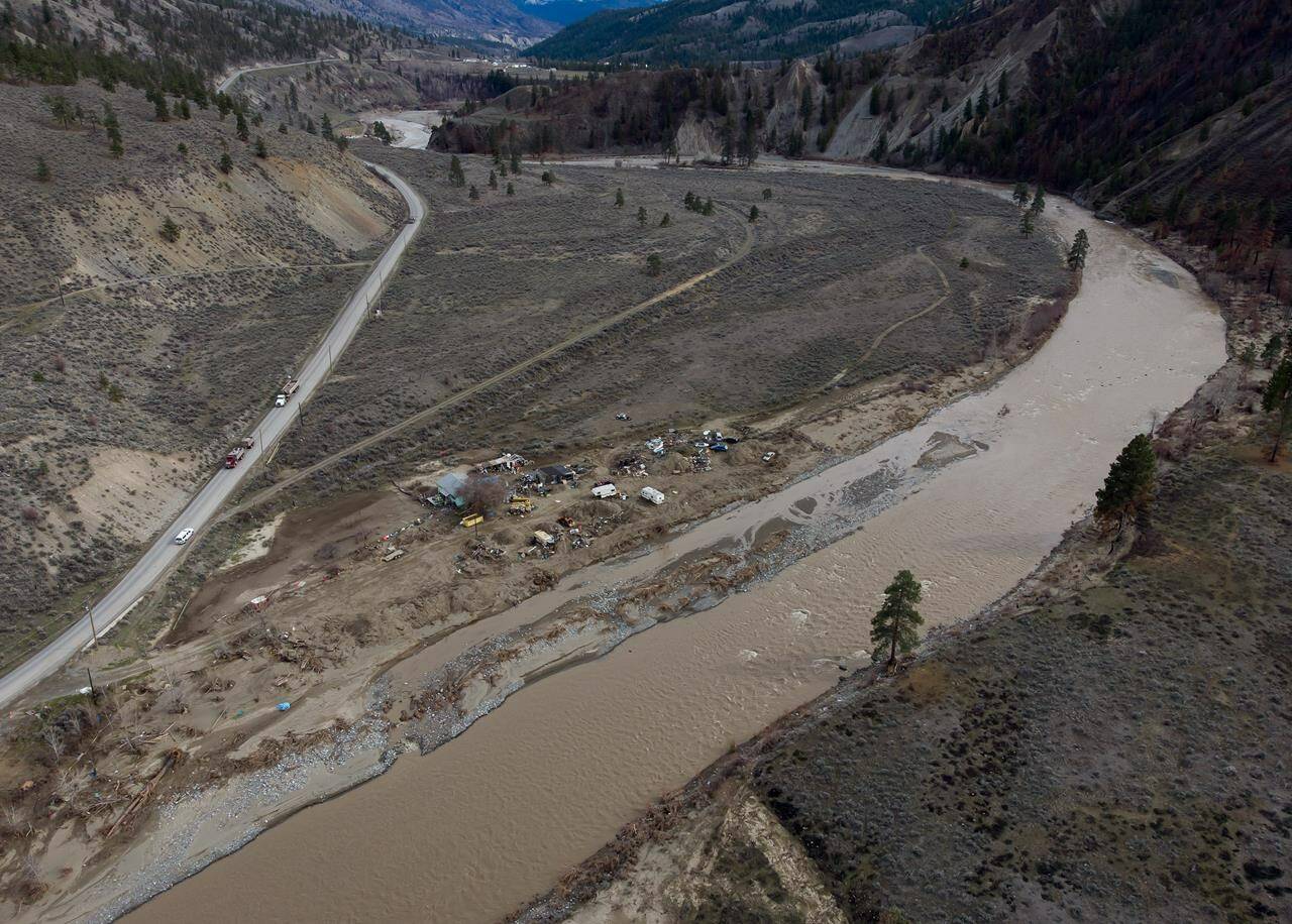
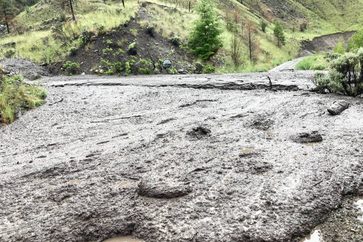
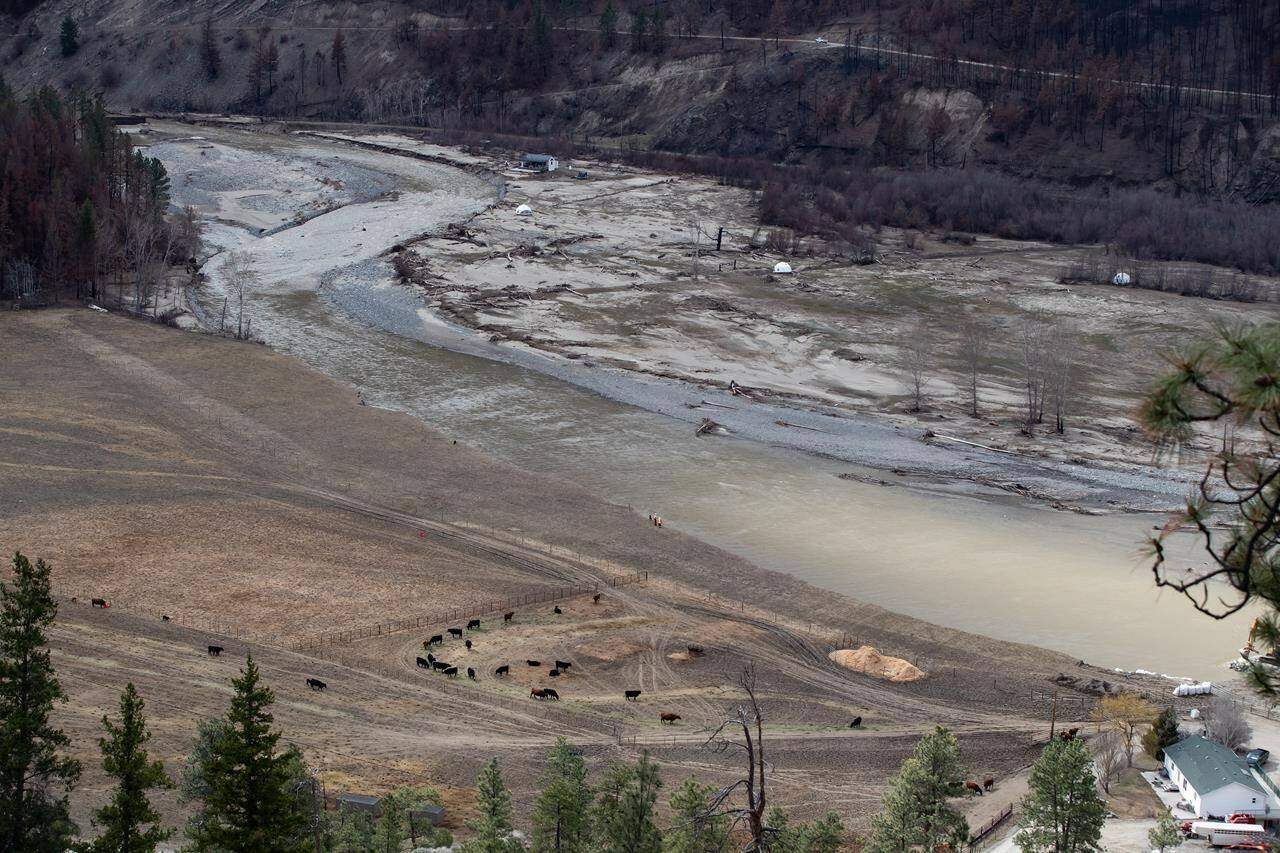
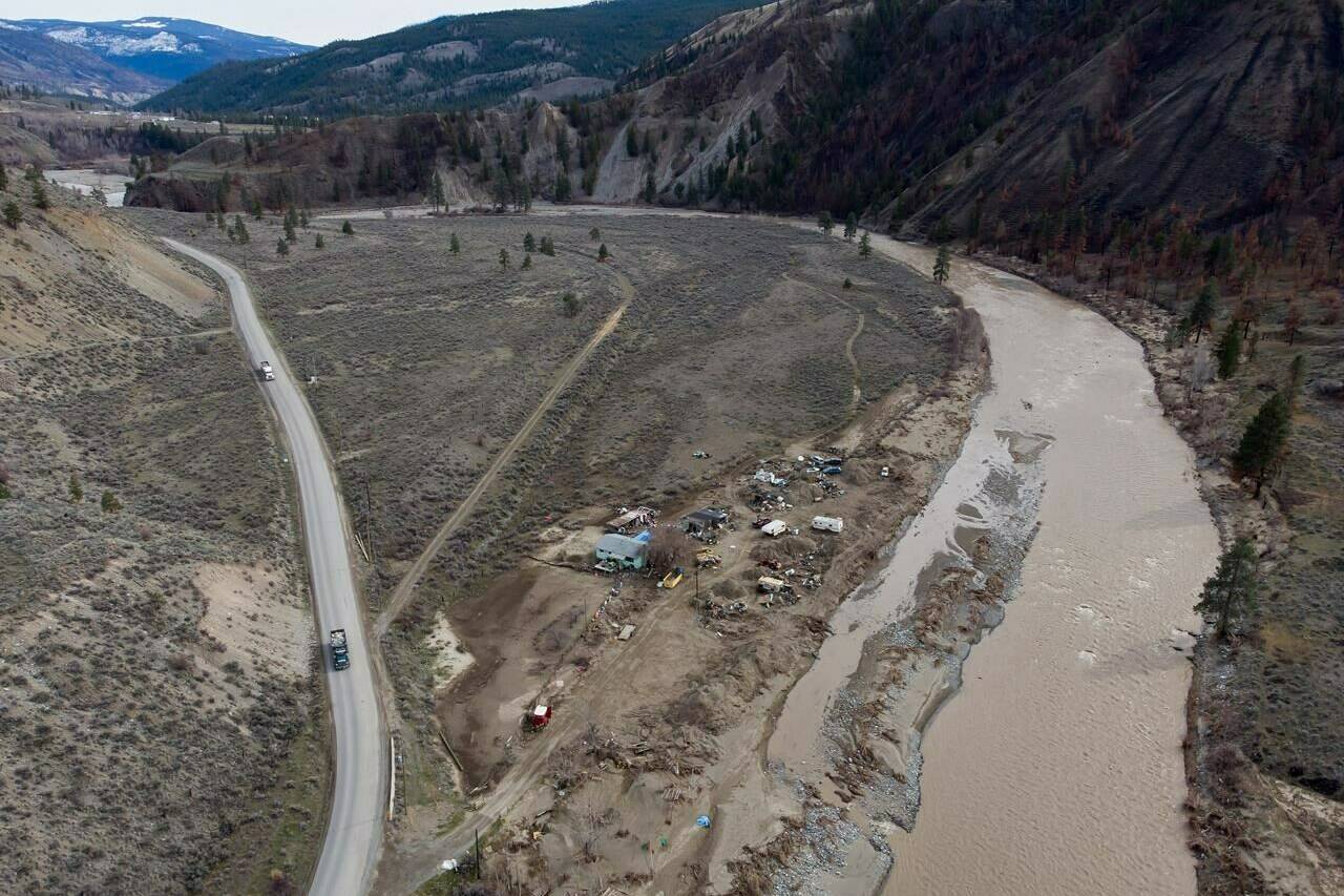
Wildfires, droughts and mudslides raise questions about Nicola River’s ability to handle spring thaw

Trucks haul loads of rock on a section of Highway 8 along the Nicola River that had to be rebuilt after it was washed away during November flooding on the Shackan Indian Band, northwest of Merritt, B.C., on Thursday, March 24, 2022. Major wildfires, droughts and mudslides last year dramatically altered the landscape, raising questions about the river’s ability to handle the spring thaw. THE CANADIAN PRESS/Darryl Dyck
A property affected by November flooding of the Nicola River is seen along Highway 8 on the Shackan Indian Band, northwest of Merritt, B.C., on Thursday, March 24, 2022. THE CANADIAN PRESS/Darryl Dyck

After the flood: First Nations along B.C.’s Highway 8 work on recovery

People grapple with tough questions about how best to rebuild after twin climate change disasters

A property affected by November flooding of the Nicola River is seen along Highway 8 on the Shackan Indian Band, northwest of Merritt, B.C., on Thursday, March 24, 2022. THE CANADIAN PRESS/Darryl Dyck
The Yukon provincial flag flies on a flag pole in Ottawa, Monday July 6, 2020. Yukon’s snow survey shows record high snowpacks in many of the basins the territory monitors. THE CANADIAN PRESS/Adrian Wyld

Yukon’s record snowpack adds potential for flooding during ice breakup

April survey usually represents the peak snow levels in most of the territory

The Yukon provincial flag flies on a flag pole in Ottawa, Monday July 6, 2020. Yukon’s snow survey shows record high snowpacks in many of the basins the territory monitors. THE CANADIAN PRESS/Adrian Wyld