An innovative monitoring system off the west coast of Vancouver Island hopes to help scientists better understand the most devastating earthquakes.
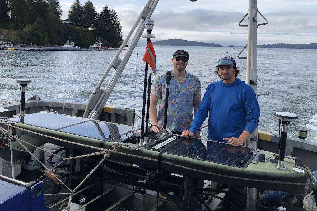
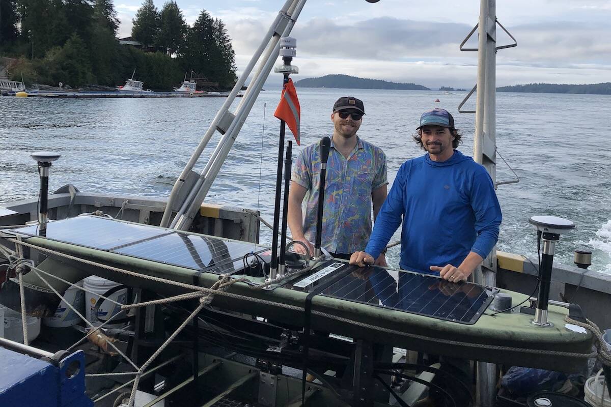
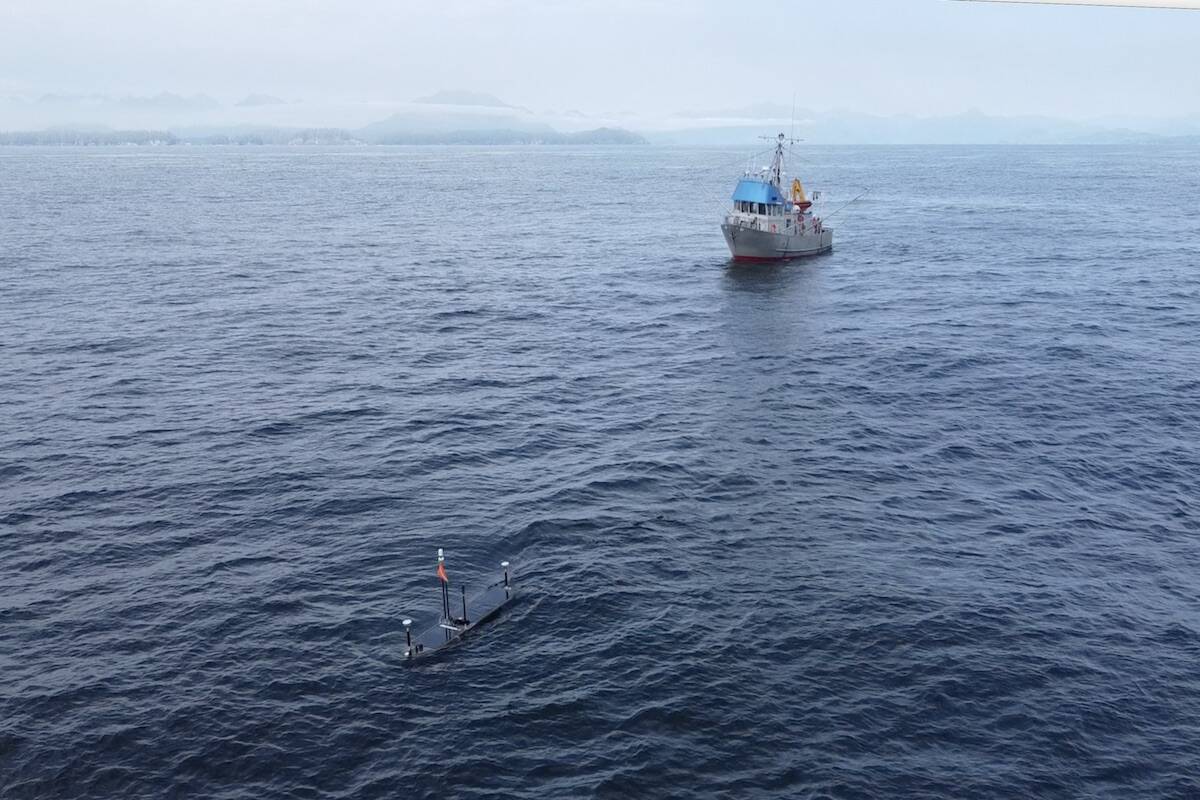
Ocean Networks Canada (ONC), a University of Victoria initiative, wrapped up an initial two-month marine geodesy mission in August. The mission, led by ONC staff scientist Martin Heesemann and his team, involved using a remotely-operated, solar-powered surface glider to observe 21 acoustic transponders located on the sea floor.
The monitoring system is the largest of its kind in North America due to the number of transponders and the area they cover across the northern Cascadia subduction zone. It’s also rare as earthquake monitoring systems are mainly restricted to land.
The transponders are fixed to the ocean floor and therefore move with the tectonic plates in the area. Since GPS can’t penetrate water, the transponders acoustically signal their location to the glider on the surface, which then relays the data to the researchers.
The Juan de Fuca plate is subducting under the North American plate off the Island’s coast.
“Those subduction locations are where the greatest earthquakes in the world occur,” said Kate Moran, president and CEO of ONC, in an interview. “So understanding the motion of those plates and how that motion is linked to earthquakes is critical.”
Critical because the megathrust shakes can reach devastating magnitudes nearing the double digits, Moran added. The 2004 megathrust earthquake in the Indian Ocean triggered the tsunami that killed nearly a quarter of a million people in the 17 countries it impacted.
There are few marine geodesy projects worldwide and compiling data from all of them could help scientists better understand subduction earthquakes.
“We don’t have the ability to forecast earthquakes but understanding plate motion and earthquake behaviour will advance the potential of that in the future,” Moran said. “This understanding of behaviour off-shore will be eye-opening because we have no idea at this stage.”
It’s not fully understood how much movement is occurring. The mission this summer will serve as the base data set and the glider will be redeployed every year to measure how far the transponders have moved.
The scientists are also looking into whether the plates off Vancouver Island are moving slowly along the fault – a process called slow slip. Slow slip has been identified as a possible precursor to large subduction earthquakes, like the one in 2011 that rocked Japan.
“It’s those kinds of big events that we really want to learn more about,” Moran said.
A near-field tsunami could reach Tofino in about 15 minutes, prompting that community to be proactive in running drills with residents. But Moran said it’s a reminder that people visiting the Island’s coastal zones should always be prepared with an escape route.
READ: 320 years since the ‘Big One’ doesn’t mean it’s overdue: Canada Research Chair
jake.romphf@blackpress.ca. Follow us on Instagram.
Like us on Facebook and follow us on Twitter.
vancouverislandVictoriaWest Shore


